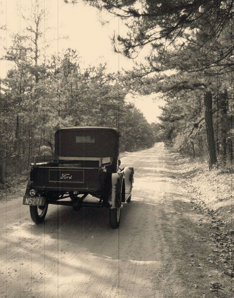
An early traveler begins the tedious climb up Apple Pie Hill (photo by Harry Silvers)
This tour route will guide you to the marked and unmarked historical sites of our town. In this handout the site numbers may seem out of sequence, but it is made to follow the easiest route and you will be able to visit all the sites. The story behind many locations is listed in the site’s description. We continue to add more information as time and research permit.
OUR LOCAL HISTORIC SITES
Download the printable version of this tour so you can take it with you.
This tour route will guide you to the marked and unmarked historical sites of our town. In this handout the site numbers may seem out of sequence, but it is made to follow the easiest route and you will be able to visit all the sites. The story behind many locations is listed in the site’s description. We continue to add more information as time and research permit.
After parking your car at Town Hall (the corner of Route 532 and Carranza Road), enjoy the first ten of our historic sites with a short stroll around the area.
The blue signs will describe what once stood (or still stands) in the core area of our “Gateway to the Pines.” Please refer to the map for exact locations.

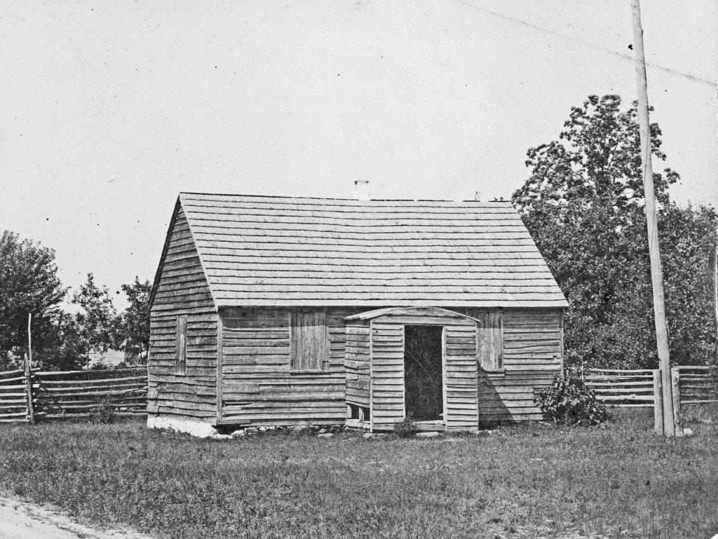
- 1. Brainerd Church
- 2. Old Tabernacle Cemetery
- 3. Henry Peter’s Store
- 4. Blacksmith Shop
- 5. Kemble Inn
- 6. Early schoolhouses site
- 7. Junior Mechanics Hall
- 8. Willits Store
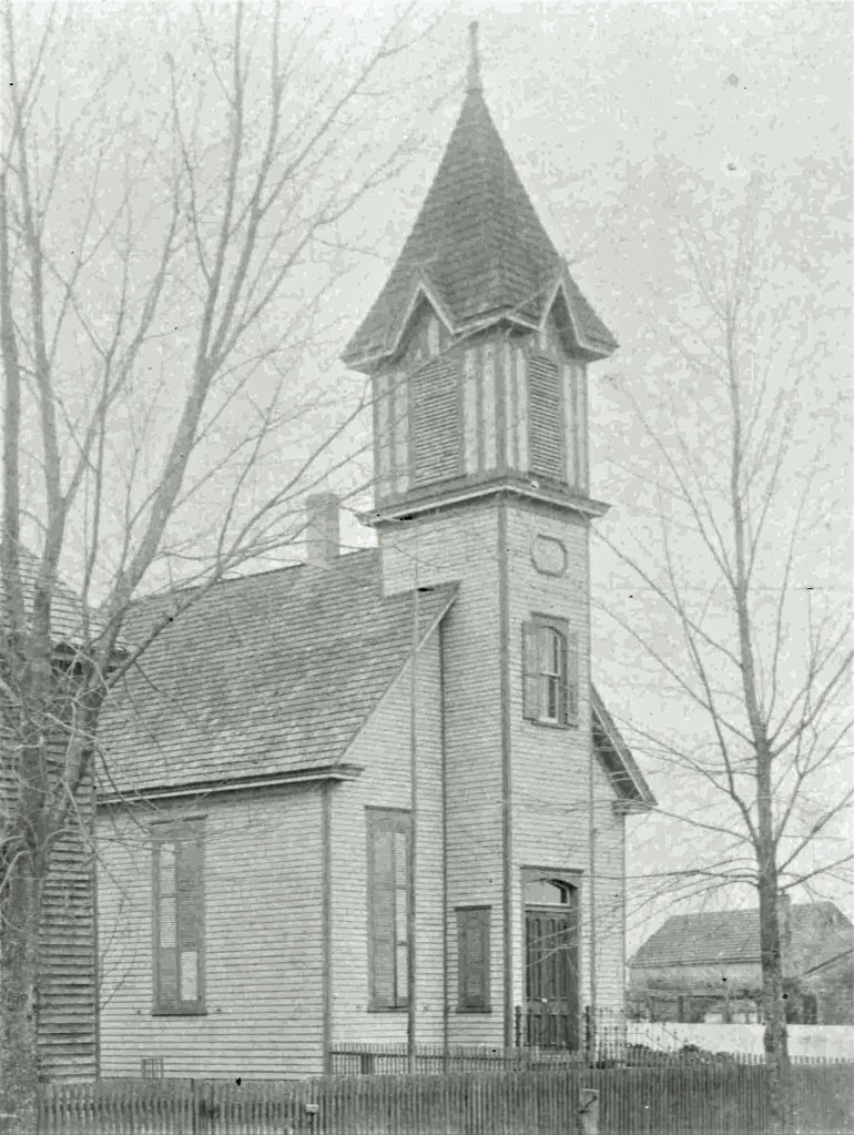
- 9. Methodist Church
- 10. Knight Pepper House
- 11. Fox Chase Tavern site
- 12. Harvest Home Picnic site
- 14. Friendship Sawmill site
- 15. Pine Tavern site
- 13. Isaiah Bowker Homestead
- 31. Union School site
- 30. Naylor’s Corner Tavern site
- 29. Stage Coach stop
- 25. Stamping Mill site
- 24. Hampton Gate Tavern site
- 23. Carranza Monument
- 22. Eagle Graves site
- 20. Eagle Tavern site
- 21. Speedwell site
- 18. Apple Pie Hill
- 19. Harris Station site
- 17. White Horse Tavern site
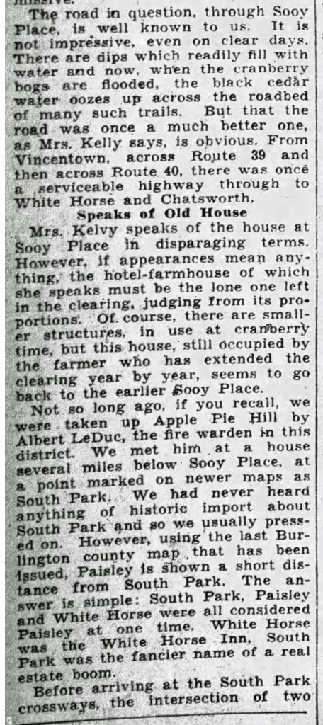
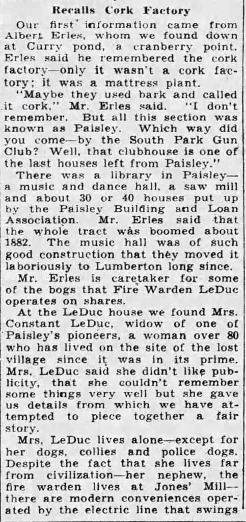
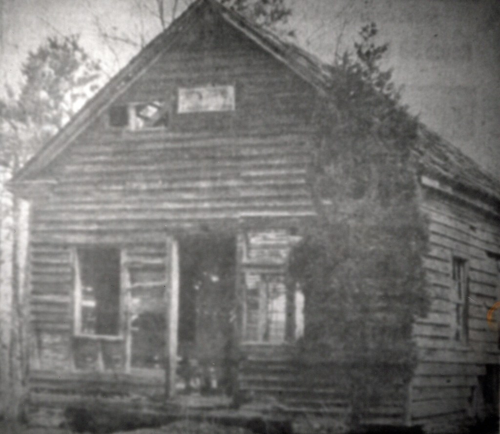
- 16. Paisley land swindle site
- 26. African Church and Burial Ground site
- 28. Severs Log Cabin site
- 27. Warner Log Cabin site
- 32. Friendship Schoolhouse
#1 Brainerd Church – Site of the Tabernacle in the Wilderness Church GPS: (N39.84437, W074.71099)

#2 Old Tabernacle Cemetery GPS: (N39.84422, W074.71089)

OLD TABERNACLE CEMETERY
from the pamphlet “Historical Tabernacle: a pictorial tour”
Reverend Brainend’s little church was still standing in 1803 when William and Sarah Wilkins, who owned the land around it, deeded two acres (for the sum of eight dollars!) to the then twenty-eight
residents of the township (known at the time as Northampton) for use as a church yard and cemetery “as long as wheels of time shall not cease to flow.” The old deed is still extant. Family names such as Moore, Alloways, and Bowker are listed on the document. The cemetery is often referred to as a Methodist one, but from its inception, it was intended to be, was, and is interdenominational. Many visitors start tracing their Piney roots in that cemetery.
Some of them recall, as they try to read worn, illegible names and dates, of the days when the term “Piney”was pejorative. Even in these days when ethnic slurs are no-no’s and one sees bumper
stickers on cars and pickup trucks proclaiming: “Piney Power,” there are still some people who take exception to the term, which they believe is a put-down. Previous stereotypes of Pineys perpetuated by the news media of bygone eras caused most of the above mentioned people to adopt that attitude.
It is true that many of the early Pinelands settlers chose the then vast wilderness area because of its remoteness from law enforcement and public opinion. It is said that more than a few Hessians, weary of the rigors of being mercenary soldiers, found their way to the Pinelands from Trenton where General Washington had launched a successful surprise attack against their employers the British.
Several Quakers from Philadelphia and Moorestown who refused to bear arms during the Revolutionary War took refuge in the Pines from the wrath of their more militant neighbors. Conversely, some Quakers who did take up arms and were read out of meeting for doing so also found their way here. The name Bozarth (spelled Bozearth on one gravestone) is reputedly a Huguenot name. Huguenots settled nearby Mt. Misery.
#3 Henry Peters Store (Nixon’s today) at Rte 532 and New Road GPS: (N39.84426, W074.70944)

#4 Site of Blacksmith Shop at Carranza Road south across the street from the Kemble Inn GPS: (N39.84358, W074.71054)

#5 Kemble Inn GPS: (N39.84361, W074.71069)

#6 Early schoolhouses site GPS: (N39.84417, W074.71115)


#7 Jr. O.U.A.M. or Junior Mechanics Hall, now Tabernacle Township Municipal Building GPS: (N39.84408, W074.71132)

#8 Site of Willits Store (later Haines’) on Carranza Road north, next to the Old Tabernacle Cemetery GPS: (N39.84463, W074.71132)

A brief history of the property
In 1850 one Robert Wilson, an Englishman, was selling groceries from this store. Later owners were Wesley Willits and Charles Austin. When Arthur Haines married Charles” daughter Amanda, he became the store owner.
Robert Wilson (born 1806) was married to Rachel (born 1829) and they had at least five children. They were Charles (1842), Thadius (1846), William (1851), Robert Jr. (1853) and Melvin (1855). By 1870 all but Robert Jr. had died and the store passed into the hands of Wesley Willits. The Wilson family is buried in the Old Tabernacle Cemetery, row 12, lot 2 and, row 13, lot 2.
Charles Austin (1831-1907) and his wife Hannah (1825-1896), are listed as farmers in all time appropriate censuses. They had at least six children: Adeline (1853), Sarah (1856), Mary (1858), Charles (1860), Anna (1863) and Hannah (1868). Charles also may have served as a county freeholder.
Charles and Hannah are buried in the Old Tabernacle Cemetery, row 43, lot 1.
Charles’ daughter Amanda (Adeline in early censuses) married Arthur Haines (1843-1911) in 1871. He soon became the proprietor of the store. In the 1900 census he is listed as a farmer and grocery-man. Children are H Evelyn (1878), William (1884) and John Ralph (1895). In the last census before his death (1910), Arthur is listed as a merchant and farmer with a grocery store.
In the 1920 census Amanda is listed as the manager of a store. So it appears she took over after her husband passed away. After she died in 1927,son John Ralph Haines took over the store. By 1930 he is listed in census data as a retail merchant in a grocery store.
By 1940 John Ralph is listed as an electrical engineer for the Arrow Safety Company. His first cousin, once removed, Richard I Haines, has taken over as operator of the store.
John Ralph Haines may have had a part in the development of the “turn signal” for modern day automobiles. In the possession of a local resident is an actual antique model of the device which John Ralph Haines developed.
Richard I Haines took over the store in 1937. He also took to administering the property next store, the Old Tabernacle Cemetery. It had been neglected for years and was completely engulfed with overgrown vegetation. Through his efforts it was cleaned up and put back into use.
By 1958 Richard not longer owned the store. In later years it was owned by a family named Schultz, used as a floral shop and finally purchased by Gary Gravatt.
#9 Methodist Church GPS: (N39.84502, W074.71165)
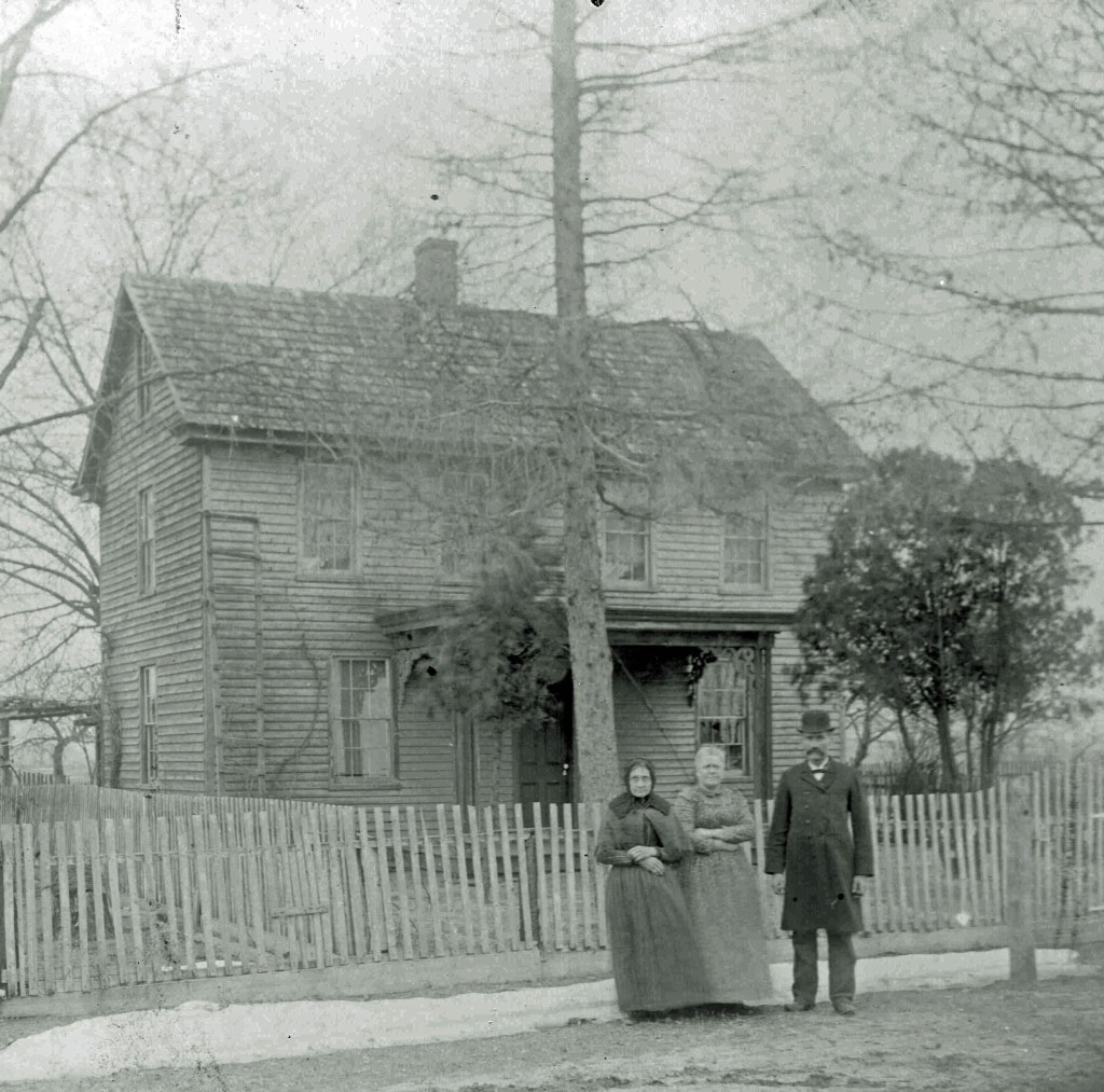
#10 Home of Gilbert Knight, also referred as the Knight Pepper House or the Pepper House across from Methodist Church. GPS: (N39.84511, W074.71188)
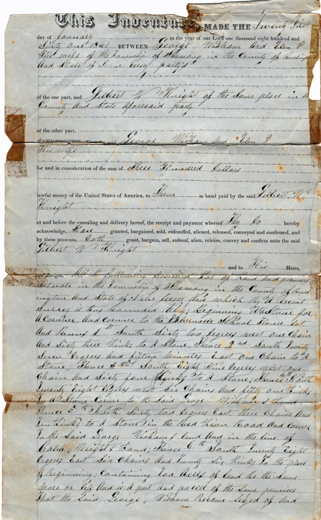
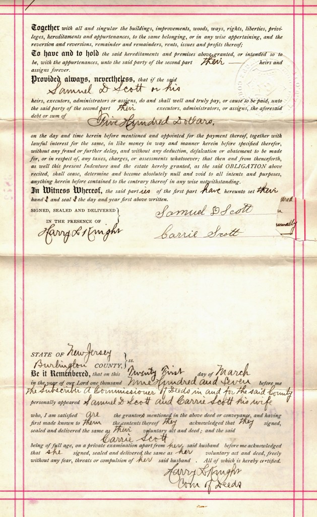
Below are the four pages of the deed, dated 21 January, 1861, filed when Gilbert Knight purchased “the land and premises” for three hundred dollars from George and Ellen Wisham. Containing two acres, the phrase “land and premises ,” seems to indicate that a structure of some type was on the location.


On the 21st of March, 1907, the below listed mortgage was drawn. Samuel Scott borrowed $500 towards the purchase of the Gilbert Knight property from the Trustees of the Tabernacle Council Number 49 of the Junior Order of United American Mechanics.
While Gilbert’s wife Elizabeth was still alive, she may not have been residing in the home. By 1910, she was a “resident” of the Burlington County Hospital for the insane. The property was transferred, via a deed of conveyance, from Elizabeth’s son Harry, step daughter Anna and husband Elwood Bennet, as well stepson George and his wife Mary Ann. The mortgage was fully paid in 1938.


To see a video tour of the Knight-Pepper House please go to https://tabernaclehistoricalsociety.org/a-tour-of-the-knight-pepper-house/ and view
“A Tour of the Knight-Pepper House.”
Before returning to your car, give yourself a moment to envision life here in the 1890’s. Many more buildings were standing. The Junior Mechanics Hall was a local gathering spot, the Haines store sold groceries and the Cemetery was actively in use. The school sat right on the corner of Carranza and Medford Lakes Road, and a large barn stood in the parking lot of Russo’s Farm Market.
Travel north (0.9 M) on Carranza Road to where it intersects with Hawkin Road. Just about where the Seneca High School tennis courts are located stood the Fox Chase Tavern. Across the street was the picnic area for the annual Harvest Home dinners. Neither site has an historic marker.
#11 Fox Chase Tavern site. GPS: (N39.85656, W074.72127)
An early Burlington County road return shows a lot of interesting features. First is the Hosea Moore Tavern also known as the Fox Chase Tavern. It is at the center of the map.
Running downward, top left to top bottom is Red Lion/Hampton Road. This is today’s Carranza Road. To the far left, running in the same direction is the road from Jacob Prickett’s to Huckleberry Hill. It’s probably today’s Oak Shade Road, in part as it runs behind our closed Township Landfill.
The road slicing through Tabernacle and labeled Road from Oliphants Mill is today’s Medford Lakes Road.
Most interesting is the road terminating at Hosea Moore’s Tavern. It is today’s Hawkin Road. As the note on the map indicates, the “dotted line” road, from Medford to Manahawkin has been vacated in favor of a road directly to the Moore property. The “dotted line” road ended at Friendship Sawmill. At some point a road from Moore’s was completed directly to Friendship. It ran through the Seneca High School property and right to Friendship. The drivable portion is today known as Foxchase Road.
While we haven’t seriously traced the rest of the road to Manahawkin, we know enough to understand the route it most likely took.
This map helps validate the origin of the name Hawkin Road, short for Manahawkin. A few now deceased township residents had suggested this to us many years ago, and it looks like their thoughts are on target.
Any comments on this, please post on our Facebook page “Tabernacle Historical Society”

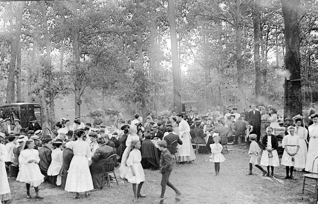
#12 Harvest Home Picnic site GPS: (N39.85673, W074.72185)
We can document the Harvest Home picnic to 1876. There may have been earlier, but this is the first reference we find to one. From ” Indian Mills Charge Methodist Episcopal Church for Tabernacle, Hartford (Shamong), Atsion and Dicksontown,” we find the following entry.
“Tabernacle – Picnic – On the 31st of July (1876) a Sunday School picnic was held in Haines Woods. About $22.00 + were made by the sale of refreshments.”
And from the same document we have this 21 August 1922 entry. “Tabernacle Church held their Harvest Home Supper. Owing to a severe shower in the afternoon they did not do as well as usual. After all bills was paid, cleared $303.28.A donation of $5.00 after the supper and an ice cream sale with a profit of $8.88 made them a total of $317.16.”
Return south on Carranza Road and turn left at the cemetery to Route 532. Go one short block and turn left (at Nixon’s) on New Road. The next intersection (1.3 M) will be with Friendship Road. Turn right and follow the twisty road (0.6 M) to Site #14.
#14 Friendship Sawmill site – “Hamlet” or area with saw mill, schoolhouse, cranberry packing house and private home. Cornerstone boundary of four early townships. GPS: (N39.86938, W074.69572)

Continue in the same direction (0.1 M) to the stop sign. Turn right onto Powell Place Road and drive (2.4 M) to the intersection with Sooy Place Road. Right in front of you will be the location of the former Pine Tavern.
#15 Pine Tavern site. GPS: (N39.86780, W074.65254)
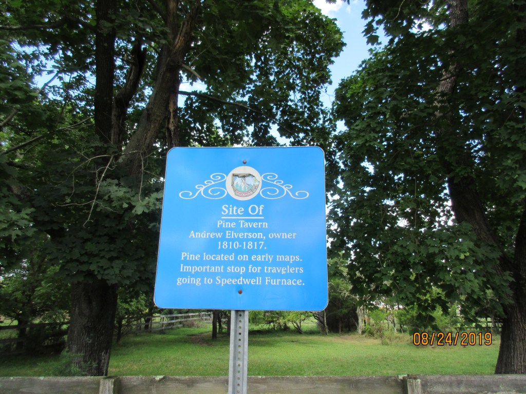

The following two pictures come to us from the William Augustine Collection at Rutgers University. Augustine frequently accompnied Henry Beck on his jaunts and took many of the pictures used in his books and Camden Courier Post articles.


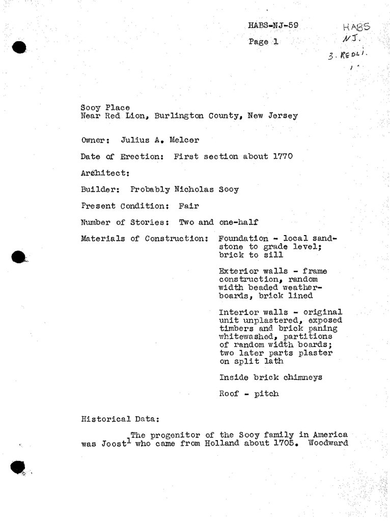
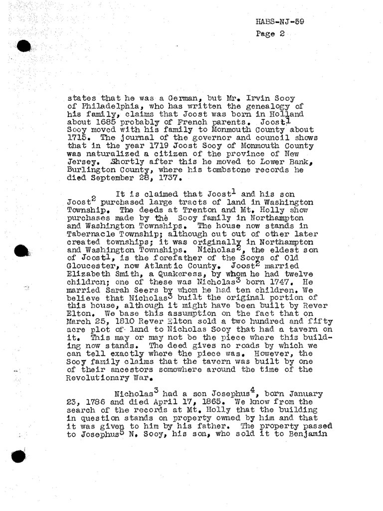
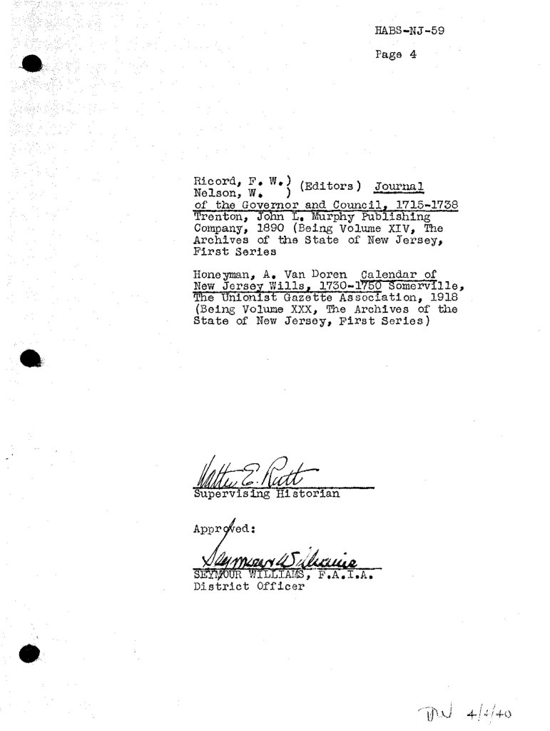
The following document has been provided to us by Wil Dirkin. It comes from the Historic American Buildings Survey, year unknown, and is entitled “Sooy Place, near Red Lion, Burlington County, NJ.” It is the descriptive lead in document for the site noted in the first Tavern picture above. As a clarification, Both Sooy Tavern and Pines tavern are names given to this structure at various times.


Return in the direction from where you came, turning left on Friendship Road until you reach the intersection (3.0 M) with Patty Bowker Road. Turn left and proceed to the intersection with Zimmerman Road (0.4 M).
#13 Isaiah Bowker Homestead GPS: (N39.86115, W074.69752)

Next turn right and follow Zimmerman Road (1.0 M) to Chatsworth Road (Rte 532). Turn right, go (0.8 M) to Carranza Road (at Russo’s Farm Market) and turn left. Make a quick right on Flyatt Road. Proceed to Old Indian Mills Road (1.1 M) where you should turn left. After traveling 0.8 miles you will reach Site #31.
#31 Union School site GPS: (N39.82301, W074.72713)
Continue to Tuckerton Road (0.5 M) by way of Old Indian Mills Road and turn left.
#30 Naylor’s Corner Tavern site. GPS: (N39.81558, W074.72693)

Follow Tuckerton Road (0.1 M) to the former stage coach stop and post office.
#29 Stage Coach stop. GPS: (N39.81500, W074.72466)

Stay with Tuckerton Road to Dingletown Road (1.2 M). Turn left and then right onto Carranza Road (0.4 M). Just ahead (1.4 M) is the site of a “stamping mill.”
#25 Stamping Mill site GPS: (N39.80249, W074.67469)

After another 0.20 miles on Carranza Road you will arrive at the Hampton Gate site. No longer any tolls to pay here! And no historic sign is posted.
#24 Hampton Gate Tavern site. GPS: (N39.80033, W074.67194)

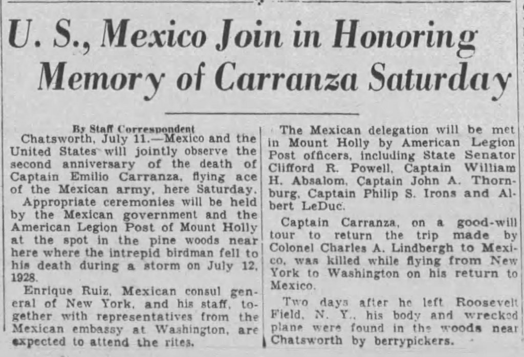
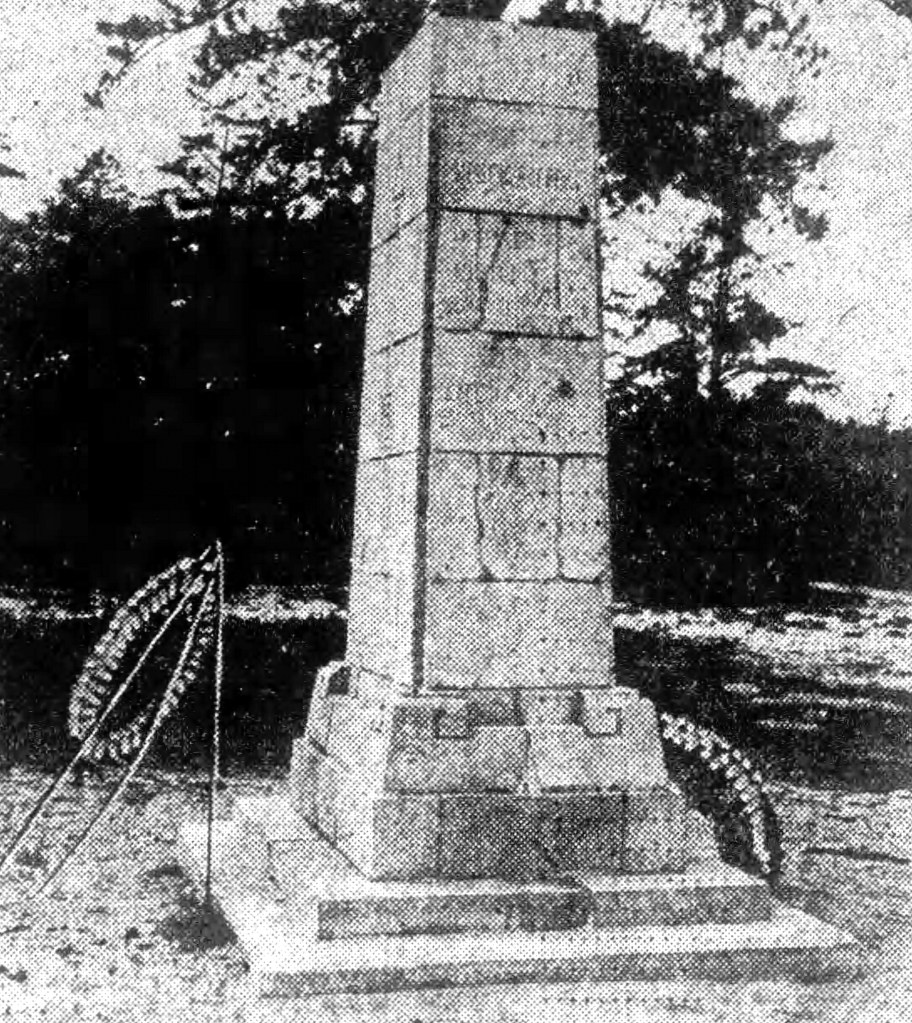
Follow Carranza Road to the Carranza Monument (2.9 M) on the right hand side of the road.
#23 Carranza Monument GPS: (N39.77757, W074.63236)
The following article appears on a Facebook page dedicated to Emilio Carranza.
The History of Captain Emilio Carranza
Emilio Carranza Rodriguez was the fourth child born to Sebastián Carranza Cepeda and María Dolores Rodríguez Gómez. He was born on December 9th, 1905 in the town of Ramos Arízpe, Coahuila, Mexico. Emilio’s grandfather, Sebastián Carranza de la Garza was the brother of Venustiano Carranza (1859-1920), who was first Constitutional President of Mexico from 1917 until his assassination in 1920. Emilio’s father was a businessman and a government official, who at the time of Emilio’s death in 1928, was an accountant at the Mexican Consulate in New York City.
In January 1928, just 6 months before his death, Emilio married Maria Luisa Corbala of Sinaloa, Mexico. Following the death of Emilio, Maria Luisa moved to Guadalajara. The young widow had a child in 1929, who was named after his father, Emilio. Sadly, young Emilio died of an appendicitis when he was six.
Emilio was the nephew of General Alberto Salinas Carranza, one of Mexico’s aviation pioneers. The family always talked about Emilio’s love of airplanes and his dreams to become a pilot. Not surprisingly, the young aviator’s idol was Charles Lindbergh. Emilio’s brothers Sebastián and José were also involved in aviation. Sebastian often flew with Emilio, and both Sebastián and José were accomplished aircraft mechanics. Sebastián was involved with civilian aviation the rest of his life, working primarily for Pan-American Airlines in Mexico.
When Emilio was 11, he would travel to the school of military aviation everyday with his uncle, General Alberto Salinas Carranza, the first director of the School of Military Aviation of Mexico. While at the school of aviation, he would pretend to fly the airplanes as they sat in the hanger.
At age 18, Emilio became a student at the academy and advanced quickly through the theoretical portion of his training. Emilio stood out for his amazing memory; On one of the bimonthly exams in Aerodynamics, asked for six of the one hundred and twenty values from a table of barometric pressure, relative pressure, and relative temperature at different altitudes. In his answer sheet, Emilio wrote down all one hundred and twenty values without a single mistake.
This raised suspicion on behalf of the faculty, that Emilio may had cheated on his exam. The faculty members located Emilio playing basketball and informed him of their suspicion. Emilio promptly invited the faculty members to a nearby empty classroom where he replicated the entire table on the blackboard from memory and without errors. He was immediately awarded a outstanding grade on the exam.
Emilio also demonstrated enormous practical flying skills even at the early age of 19. After completing his flight test on a Mexican built Avro biplane, Emilio earned the title of “Pilot of Aviation”. In 1924 he became a national hero, flying for the government, against rebels in the north.
In September 1927 Carranza made the 965-mile nonstop flight from Mexico City to Ciudad Juárez, landing on the same day that Charles Lindbergh arrived in El Paso, Texas, just across the Rio Grande. The two became friends, and they renewed their acquaintance three months later when Lindbergh made a goodwill fight from Washington, D.C., to Mexico City. The trip was promoted by Dwight Morrow, newly appointed American ambassador to Mexico, former consultant on U.S. aviation policy and Lindbergh’s future father-in-law, who also recognized the potential benefits of air travel to diplomacy.
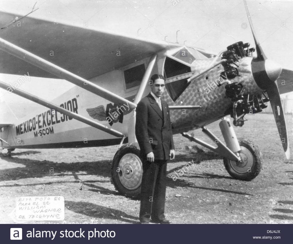
Like Lindbergh, Emilio also flew a Ryan Brougham B-1 monoplane, named the Mexico-Excelsior. It was built in San Diego by the B.F. Mahoney Aircraft Corporation and was a virtual twin of Lindbergh’s Spirit of St. Louis.
On June 10th, 1928, at 8:08 am, Captain Carranza took off in the “Mexico-Excelsior”. After lifting his monoplane over the 12,000 foot high mountains that surround Mexico City, he set a heading toward Tampico. Fellow aviators took off to escort the Mexican flyer out of the Mexico City valley.
Word of Captain Carranza’s goodwill flight spread quickly throughout Mexico over dedicated telegraph lines that the Civil Aviation Department installed to follow the flier’s progress. News of his imminent arrival in Washington prompted people to start gathering at Bolling Field, but word came that Captain Carranza had been forced to land due to heavy fog over the Carolina’s. Captain Carranza circled the town of Mooresville, NC and landed the “Mexico-Excelsior” at 3:30 am, just 300 miles short of Washington DC.
Captain Carranza left Morresville NC at 1:50 pm on June 13th. He continued his flight along the Atlanta – New York postal route, and arrived in Bolling Field, Washington at 5:15 pm on June 12th, 1928. The first to greet Captain Carranza upon landing was Major Davidson, Commanding Officer of Bolling Field. Captain Carranza was welcomed by Acting Secretary of State Robert E. Olds, Mr. Manuel Téllez, the Mexican Ambassador, and many other officials. The following day, Captain Carranza was called on by President Coolidge who invited him to lunch at the Pan American Union dining room. He later placed a wreath at the Tomb of the Unknown Soldier in Arlington National Cemetery.
On June 18th, Captain Carranza landed at Mitchell Field in New York City. Major General Hanson E. Ely greeted him as he exited the airplane. Mayor Jimmy Walker greeted Emilio at City Hall, and gave him the symbolic “key to the city”. Captain Carranza was busy on a round of engagements that took him to review the troops at West Point and many other places.
Captain Carranza’s return flight to Mexico City was originally scheduled for Monday July 9th, 1928 but was postponed twice because of poor weather. On Thursday, July 12th, preparations for the flight to Mexico City had attracted a crowd. Mechanics of the Wright Company conducted a thorough pre-flight inspection of the “Mexico-Excelsior”. At Captain Carranza’s request, the airplane’s fuel load was reduced from 430 gallons to 390 based on Captain Carranza’s estimate for the 27-hour flight to Mexico City. Concerned that his heavily loaded airplane might pose a danger to the assembled crowd at Roosevelt Field, Captain Carranza announced late in the afternoon the indefinite postponement of his flight due to the bad weather.
While having dinner with his family at the Garden City Hotel, Emilio received a telegram from General Joaquín Amaro, ordering his immediate return. Being the military man that he was, he obeyed the order of his Superior Officer even knowing it could be his last flight. The airport officials and the weather bureau were powerless to stop Captain Carranza, because he was acting under a direct military order. Captain Carranza took off on the 2,400 mile non-stop flight to Mexico City. His B-1 Ryan Brougham Monoplane lifted off without difficulty after a 3,000 foot run. Captain Carranza circled the airfield twice before heading south. He planned to circle Washington DC and then set a direct compass course toward Mexico City. He was expected to arrive at midnight on July 13th, 1928.
The Associated Press wired news of Captain Carranza’s departure to Mexico City, where word spread quickly. The people of Mexico eagerly awaited the return of their famous aviator. Mexican government officials, US Ambassador Morrow, and the entire staff of the United States Embassy in Mexico City planned to be at the Balbuena airfield to greet Captain Carranza upon his arrival. At about 8:00 pm, the roar of an airplane was heard near Chatsworth NJ about 85 miles southwest of Roosevelt Field. Residents also reported severe rainfall with lightning and thunder. This was to believed to be the last contact with the “Mexico-Excelsior”.
Shortly after 3 pm on July 13th, Mr. John Henry Carr, a mechanic from the town of Chatsworth NJ, his wife, his mother, and Albertus Pepper (a friend) had stopped along the tracks of the Central Railroad of New Jersey to pick berries. As the Carrs worked their way along the railroad line, they came upon several large splinters of wood. Finding additional fresh splinters, Mr. Carr decided to leave the vicinity of the tracks to further explore the thick underbrush. Soon thereafter, Mr. Carr came upon a wing of an airplane. and after proceeding a short distance, he then spotted more of the wreckage.
Mr. Carr and his family drove into town where he telephoned the County Detective, Mr. Arthur Carbine of Mount Holly NJ. Detective Carbine then called upon the members of American Legion Mount Holly Post 11, most who were World War I aviators, to assist in a “Search and Rescue” mission. Mr. Carbine drove twenty-five miles to Chatsworth where he picked up Mr. Carr. Upon arriving on the scene, Mr. Carbine searched for the missing aviator. Soon Detective Carbine and John Henry Carr located a body of an aviator in a leather flight suit, still clutching his flashlight.
Members of American Legion Post 11 placed the body of the aviator on a stretcher, while other members of Post 11 began to cut a path in the dense brush toward the railroad tracks. Members of Post 11 formed a “protective ring” around the body of the fallen aviator, as they carried him out of the woods. The stretcher was placed on the back of a truck and was taken to the garage of Busby’s General Store in Chatsworth, NJ, where it awaited for the arrival of the County Coroner. Deputy Coroner, Mr. John Throckmorton, transported the body of Emilio to the Burlington County morgue, in Mount Holly, NJ.
Soon the news of the aviator’s death had spread around the world. Members of Mount Holly Post 11 formed a ring of honor and stood guard over the body until Mexico would come to claim their hero. Post 11 draped their own American flag over Emilio’s coffin. Shortly thereafter, a group of Army officers led by Lieutenant Mee of the Seventy Seventh Division at Camp Dix, went to Mount Holly under orders of Lieutenant Colonel Cornelius V. Wickersham. The Army officers, with members of the American Legion Post of Mount Holly, and New Jersey State Police Officers all stood post, pending the arrival of Mexican Officials who were reported on the way from New York City.
Captain Emilio Carranza’s remains were taken to New York City where thousands of people paid their respect to the fallen hero. President Coolidge offered the use of the destroyer “USS Florida” to transport the body of Emilio to the port of Veracruz, Mexico.
The offer was declined by the Mexican Government and chose to transport it by train crossing the border trough Laredo, Texas. Many cities had requested the train to reroute through their city, so their citizens could pay their last respects to the fallen eagle. It is believed that San Antonio, Texas, has never seen a bigger or more impressive funeral procession to this day. Members of American Legion were requested by the Mexican Government to accompany the body of Emilio, as he traveled to his final resting place. The flag that the Post members placed over Emilio’s coffin still hangs today in Mexico’s School of Aviation. After his death, Captain Carranza was posthumously promoted to the rank of General.
Officers of American Legion post 11 accompanied Emilio’s body into Mexico City. The friendship and goodwill that was demonstrated by all of the American and Mexican people and their governments gave Captain Emilio Carranza the title of “Ambassador of Goodwill”. Afterward, Members of Post 11 vowed to maintain and keep the memory of Captain Emilio Carranza alive, by observing a yearly Memorial Service at the crash Site on the anniversary of his death.
By doing this, the members of Post 11 have maintained and nurtured the friendship and goodwill between the two nations, which was the hope and aim for which Emilio Carranza died. Post 11’s yearly Memorial Services at the site of the crash have made Captain Emilio Carranza a legend in the Pine Barrens of New Jersey.
It is important for me to mention that the short life of Captain Emilio Carranza, the Lindbergh of Mexico, has impacted the lives of thousands of aviation enthusiasts, as well as children not associated with aviation. A good example is the life of Dr. Juan R. Tapia, who at the age of five, witnessed Captain Emilio Carranza crash land an airplane near Ajo, Arizona. John Tapia grew up wanting to be as brave as Captain Carranza, and he became the most decorated U.S. Army Officer of Mexican descent; having been awarded three Bronze Star Medals for Heroism under enemy fire with Meritorious Achievement, and seven Purple Heart medals for wounds in combat against the enemy.
Consequently, Major John R. Tapia forfeited just as many Purple Hearts because he rejected medical treatment and he refused to leave his men in battle by themselves. The seven Purple Hearts that were awarded to him were only because he had to be carried off the battlefield for extremely critical medical treatment.
On July 12, 1929, Mexican officials, American Legion members and many others, met in the woods near Chatsworth to conduct a memorial service for Emilo Carranza. Here is the article as reported in the Allentown Messenger.

Here is a 1930 Courier Post article describing a ceremony on the second anniversary of the crash.
From the Trenton Evening Times we have an article which describes the fourth anniversary memorial tribute. A monument is mentioned, but the ceremony is described as happening on Apple Pie Hill!!

In 1948 the 20th annual Memorial Service was held. This Trenton Times article describes the event.

Continue down Carranza (3.2 M) (it becomes a gravel road) until it intersects with
Speedwell Road. The former hamlet of Friendship was located here and was the original home of “our” one-room schoolhouse.
Follow Speedwell Road (a left turn off Carranza) (1.1 M) to an unmarked sand road on your left. Turn left and locate the old burial ground on your left (0.2 M).
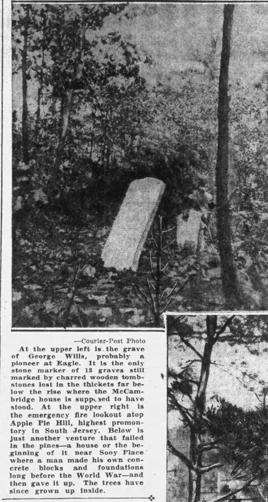
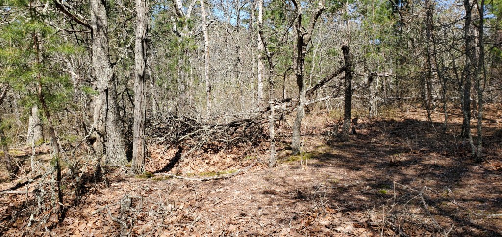
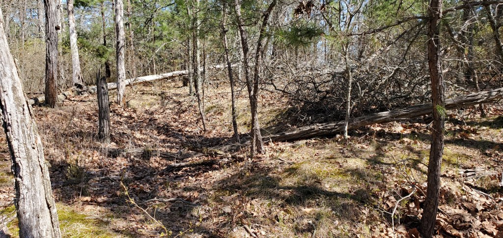
#22 Eagle Graves site Charles Wills (et al?) (1839). Look for “C W” on tombstone. GPS: (N39.76381, W074.56689)
If you continue up this sand road, (0.3 M) you will come to the site of the Eagle Hotel. However, the road may be very sandy. Use caution.

While only one grave marker remains at this site, it is believed that many more graves are within the immediate vicinity. The grave marker does not appear to be from the 1830’s and certainly was installed at a later date. It is also thought that a small town existed beyond the burial area. Yet nothing about the terrain suggests this. If true, then nature has indeed fully reclaimed it’s wooded landscape.
Charles Wills was born and died in the same year. He was one of ten children born to George (1808-1884) and Mary Dellett Wills (1809-1895). Both George and Mary are interred within the Old Tabernacle Cemetery (OTC)(row 41, lot 5) in downtown Tabernacle. Their son William Henry Wills (1833-1919), and his wife, Phoebe Emmons Wills are buried in OTC (row 41, lot 5). Son Moses, who may have never married, is also in OTC ( row 40, lot 3)
#20 Old Eagle Tavern site. GPS: (N39.76728, W074.56902)
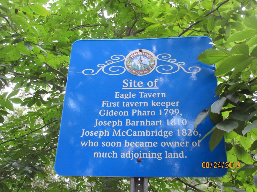
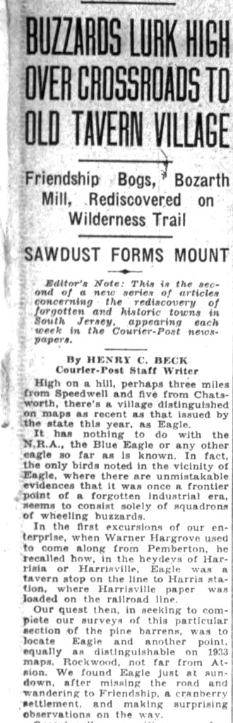
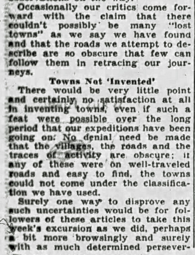
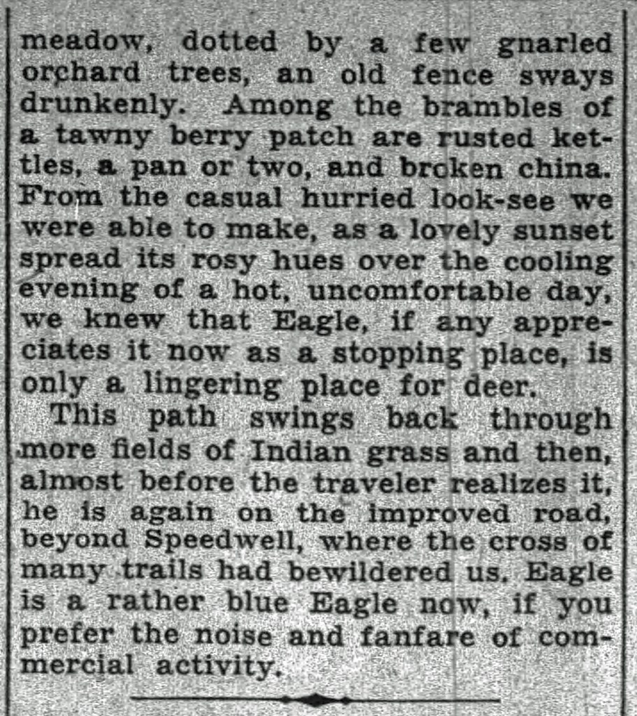
In September of 1933, Henry Charlton Beck, a columnist from the Camden Courier Post, wrote of his travels to Eagle. In his article he describes how he got lost, ended up at friendship Bogs, and later at Bozarth’s Sawmill. His article is an interesting read of this journey.


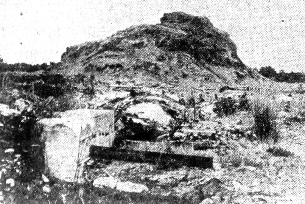

And here are a few pictures of the Eagle Hotel site as it appears in 2021.
Back on Speedwell Road, drive east (1.2 M) to the next location in Speedwell.
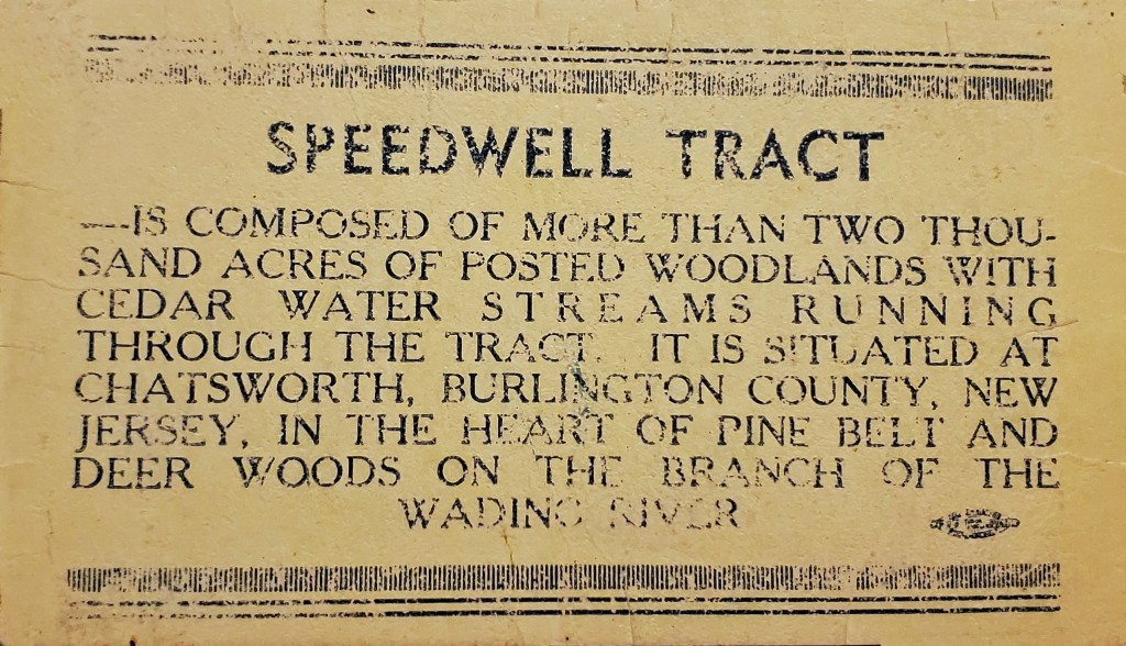
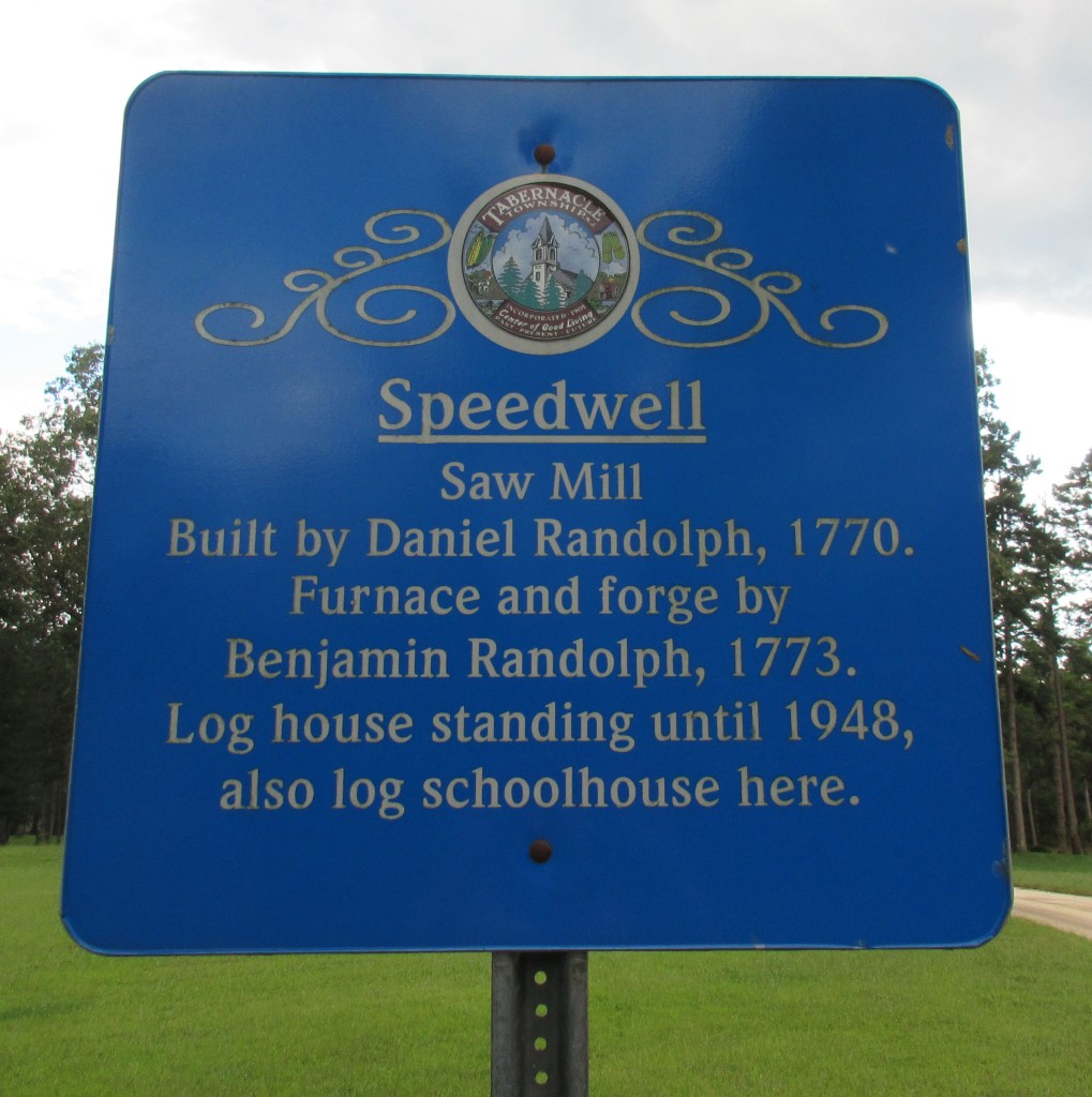
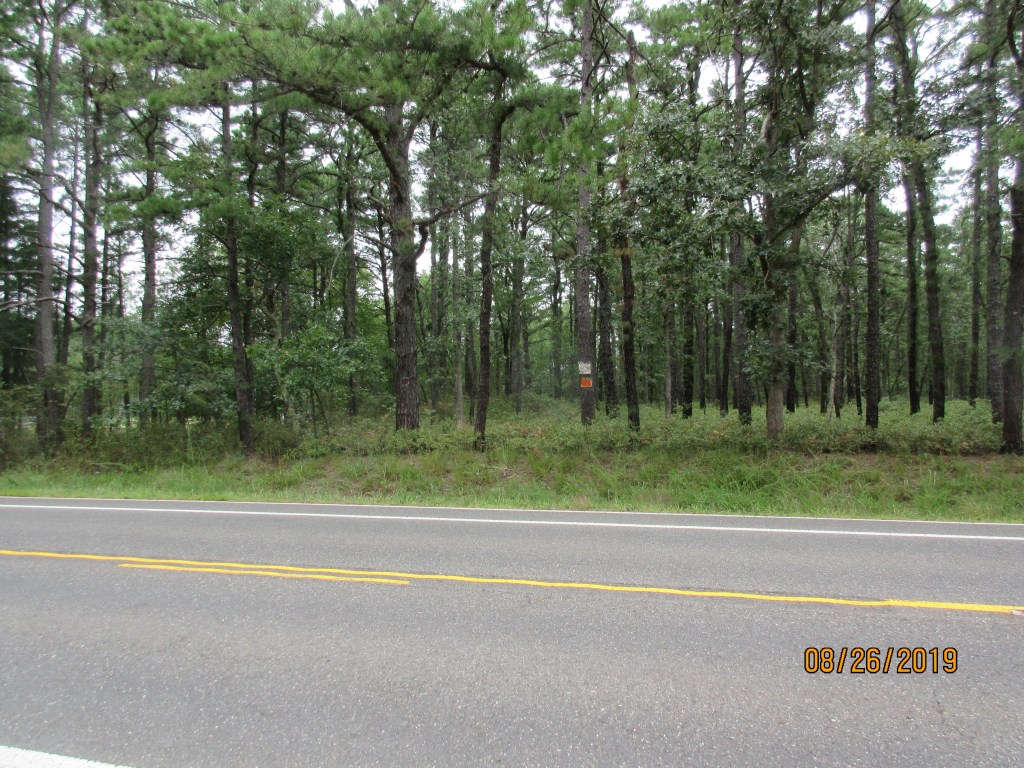
#21 Speedwell site, location of an iron furnace and sawmill. GPS: (N39.76421, W074.54459)
During the 1930’s it seems it was quite common for would be hunters, fishermen and general outdoor enthusiasts to obtain credential cards. It seems these cards gave the outdoorsman he right to be on the property. This 1934 card belonged to long time resident Clifford Worrell. It’s image is shared with us by his son Harry Worrell.

The following is provided by Alan Rowles, via his research from the book “Heart of the Pines.”
Benjamin Randolph was a Philadelphia cabinet maker of great skill and had an establishment at Third and Chestnut street in the City of Brotherly love.
In September 1 1784 he moved to Burlington and in the same year he also started the Construction of an iron furnace on his Speedwell property
Speedwell furnace was never the success of its neighbors at Batsto and Martha. It was too far from navigable water to make transportation of the pig Iron very profitable. Some was sold to nearby Union Forge near Chatsworth, the Wading River Forge and Slitting Mill and Stafford Forge but everything had to carted overland on the sandy roads.
Three years after he placed his marker stone, Benjamin Randolph, now fifty years old, remarried. He chose a widow with five children, Mary Wilkinson Fenimore. Mary had been a Quaker, but she was disowned by Burlington Friends Meeting in September 1788 for marrying an Episcopalian.
Something did not work out, and one year later, Benjamin signed over the title to Speedwell to his daughter, Anna. Within 2 years of his wedding, he was giving Speedwell as his address and apparently living there full- time with out his wife and her family.
Randolph died on the 21 of December 1791. His daughter Anna continued to live in Speedwell, and, in fact bought another 1273 acres for 300 pounds. She leased the furnace to John Sluyter, but he failed on January 14, 1797. The Sluyters moved to Georgia, but Anna would own the Speedwell property for another 44 years.
In 1798, she leased Speedwell to Joseph Walker and John Youle. These two partners bought the Wading River Forge and Slitting Mill in 1802 and the Stafford Forge in 1808. When Walker died, Youle took another seven year lease. Most of Speedwell Pigs were shipped to Stafford Forge after the burning of the Wading River forge in 1810.
After Youle’s lease expired, Anna Randolph found a new lessor in the person of Mark Richards (no relationship to the Richards family) Richards ceased production in 1829.
On December 23, 1833, Anna decided to sell Speedwell. The new owner was Samuel Richards. Anna died just a little over a year later on February 28 1835
The Randolph name did not immediately pass from the scene. Though the site of Speedwell furnace became part of Shamong Township when that municipality was formed in 1852, a new township created from old Washington Township in 1870 bore the name of the illustrious patriot, expert cabinetmaker, and iron master. Unfortunately , Randolph Township only lasted for twenty-three years.
Samuel Richards, son of William Richards and brother of Batsto Jesse, was a highly successful Ironmaster. He owned Atsion Furnace, Martha Furnace, and Weymouth Furnace, all highly successful enterprises. Even Samuel Richards could not make a go of it at Speedwell.
He tried, though. He rebuilt the furnace buildings and got things working again, but activity was sporadic. Something was always happening to cause a halt in production. Samuel Richards had given up on it before he died seven years later.
It took Stephen Colwell, Samuels executor, eight years to sell this abandoned iron works When he did so on June 30 1850, he got only $1750 for it from James McCambridge. McCambridge had been running the Eagle Tavern which stood to the northwest of Speedwell Furnace on one of the three Stage Coach routes. The McCambridge family continued to live there, until the house burned down early in the century.
Much of the this research was done by Budd Wilson. Source Heart of the Pines John Pearse
As Speedwell Road reaches Route 563, turn left, or north. Pass through Chatsworth and then turn left (after 3.7 M) on Route 532. Access to two sites will soon arise
(3.6 M). They are not reachable unless one has four-wheel drive.
Turn left on the road just west of Bordentown Gun Club. Use this GPS coordinate to locate the road. GPS: (N39.82319, W074.60174). Travel 1.1 miles on the sand road and make a left turn. This likewise sand road will take you to the parking area (about 0.25 M) for Apple Pie Hill. There is no historic marker here.
#18 Apple Pie Hill. GPS: (N39.80803, W074.58928) location takes you to the parking lot.


Return via the same route to where you made the left hand turn. Instead of turning right to get back to route 532, turn left. After one mile, you will arrive at the railroad tracks. This is the site of Harris Station.
#19 Site of Harris Station GPS: (N39.79673, W074.58147)
Return to route 532. If you look directly across the road, you will see the site of the White Horse Tavern. No historic marker is present.
#17 White Horse Tavern site GPS: (N39.82370, W074.60179)
Continue west on route 532 for (1.3 M) and reach the next location at Site #16. No sign is present so you need to use the GPS coordinates. If you reach Moore’s Meadow Road, you have gone too far.
#16 Paisley land swindle site. GPS: (N39.83193, W074.62558)


Follow route 532 to Carranza Road. Turn left and travel 2.1 miles to the next Site #26.
#26 African Methodist Episcopal Church and Burial Ground site. GPS: (N39.81486, W074.69790)
A brief history of the property
Very little is known about the longevity and history of this African American graveyard. We do know that George Eares (Ayers or Eyers) is buried there. Mr Eares was a Civil War veteran who enlisted for three years on January 23 1864. He was mustered out in less than a year (Dec 6 1865) along with all the members of his regiment. According to Civil War records we have seen, he was in “Company E, Twenty-fifth Regiment – Infantry – United States Colored Troops.” In the 1880 census he is a farmer living with three sons and a daughter.
Recently we came across a deed for the purchase of this property. It contained the following information and it is reproduced in full below. While difficult to decipher, we have highlighted relevant portions to make it easier to read.
On October 13th 1868, John Gray and his wife Mary Ann sold a small piece of land in Shamong Township for the total sum of “fifteen dollars current lawful money of the United States.” As recorded in Book C8 Page 607 in the deed books of the Burlington County Clerk’s Office, the size of the plot was 1.9 acres.
Buyers of the land were the Trustees of the African Methodist Episcopal Church. They were named as George Eayers, David Thompson and Stacey Mires. John Gray also appears to have been a Trustee. The deed goes on to say “come to be erected and built thereon a house of worship for the use of the members of the African Methodist Episcopal church and a part of same shall be used as a burial ground.”
George Eayers is most likely the Civil War Vet buried in the cemetery. You can read about him on the website at (see https://tabernaclehistoricalsociety.org/civil-war-vets/#George-H-Eares).
In the 1880 U.S. Census George Ayres is listed as a farmer, black, living with his three sons, mother and a daughter, in Shamong.
Stacy Mires is listed in the 1865 NJ State Census as “foreign born, colored male.” He may have died in 1878 as there is a will for Stacy I Myers filled with the County Clerk. He cannot be found in any other census and may have come to NJ shortly after the 1870 census.
David Thompson is listed in the 1880 U.S. census. He is listed as a black farmer in Shamong, aged 50. Along with his wife Lucinda, he lives with four sons and three daughters.
John Gray is list in the 1870 census as a black farm laborer and 70 years of age. His wife Mary Ann is “1/2 negro and Indian.” They have two children at home. According to the 1880 Federal Mortality Census Schedule, he died of Tuberculosis in July of 1879.


Continue on Carranza Road (0.1 M) and turn left on Bozarthtown Road. After 0.8 miles arrive at the first of two log cabin locations. There is no sign here as requested by the current owners. The GPS coordinates will spotlight the location.
#28 Severs Log Cabin site GPS: (N39.82489, W074.69130)
Follow Bozarthtown to Brace Road (0.1 M). Turn left. Travel 0.5 miles to your next location.
#27 Warner Log Cabin site GPS: (N39.82977, W074.69850)

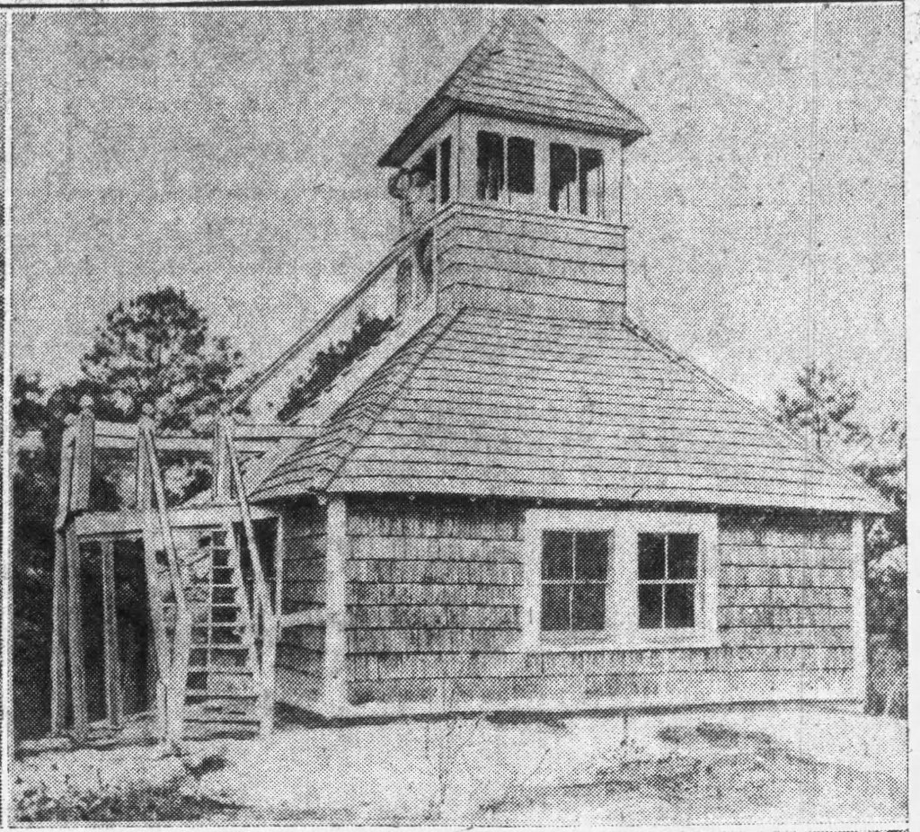
Follow Brace Road (0.4 M) back to Carranza Road. Turn right. Drive to the former Sequoia High School (1.0 M). Across from Flyatt Road is the 1890 Schoolhouse located on the Tabernacle School District property. A sign on the fence tells about the schoolhouse.
#32 Site of 1890 Friendship Schoolhouse GPS: (N39.84215, W074.70999)

The following two brief histories were written by local residents
THE FRIENDSHIP SCHOOL
Viola Sparagna
President Tabernacle Historical Society
Friendship School was built, around 1875 perhaps, away up Hampton Gate Road, now called Carranza Road. It was a narrow dirt road then. It was built for the benefit of the children in the families who lived and worked on the cranberry bogs there. The area was also known as the Quakers, possibly because the owners of the bogs, Esra Evans and Joshua Wills, were of that religious persuasion.
The school was in Washington Township but it has a lot of associations with our township so when it was being vandalized, (once it was put to use as a goat it was decided to rescue it ).
We have Mr. Herbert Gerber (now deceased), who lived on Zimmerman Road, and attended school there. You may find his face and name on the picture wall along with other pupils and some of the teachers.
One teacher, Anna Templeton, came from Bridgeboro to Medford by train where Joshua Wills met her with his horse and carriage and took her to Friendship where she boarded with a family during the school year.
Anna married Carleton Haines of Tabernacle in 1896. Robert Haines, one of their children, lived on Carranza Road all his life.
The building has 7 single desks. Imagine how crowded it was with 7 double desks.
1917—1918 was the last year the building was used as a school as there were only 4 pupils.
It was no longer sensible for the Township to pay a teacher so the children were transferred to Chatsworth School. It was abandoned until 1975 when the remains of the school were moved to Tabernacle and restored.
FRIENDSHIP SCHOOL
by Herbert Gerber
March 1986
The school was built around 1875, possibly earlier, and was in Washington Township. First teacher remembered was William Reynolds who was crippled in both legs, and walked with aid of crutches. Many times he chopped firewood after school on his knees. There was also a teacher by name of Helen Reed (or Read). Another teacher was Miss Graw. Next teacher was Miss Lilian Chew——she could have been the last there. Her two brothers, Ralph and Blair Chew, ran the saw mill at Sandy Ridge, where the mountain of sawdust was.
Joe Alloway was in the 8th Grade when Herbert started school 1913—14. Some students came from Jenkins Sooy brought them over in the school bus, a Model T of his own.
The school was heated with a pot—belly stove and burned coal (notice the coal bin in the picture behind the dog and wagon) . There was a blackboard; books were sometimes shared, sometimes individually owned. The teacher, William Reynolds, had a stick with which he could touch nearly everyone in there but never did as he had no reason to use it. His daughter attended this school prior to Herbert’s being there. His daughter was named Elva, and the family originally came from Weekstown.
In those days teachers had permission to punish students, if necessary. Studies, naturally, were the 3 R •s. You had to know your tables in the first Grade.
It is not known if the school was built by Evans & Wills or Washington Township but the teacher was probably paid by Washington Township . The school house was on the property we lived on, between the house where we lived and the barn; probably belonged to Evans & Wills for their cranberry business. Alloway and Pepper families also worked in cranberries.
The school year 1917—18 was the last year it was used as a school because the Alloways were the only children left and they were transferred to Chatsworth school. Later Gladys Alloway came to live with her grandparents in Tabernacle and went to high school from there.
There was a pond beside the school and sometimes we would put our skates on in the school to go skating on that pond. We fastened our skates on gummed boots and they had to be strapped on. If there was an inch of water on the ice, you had to be careful not to fall down! One time Ross Pepper got to close to the flood gate hole, fell in, and had to get some of pop’s clothes to walk that mile home to Sandy Ridge.
We made our own cars out of scraps of wood, old go-cart wheels, and wires. We had paths around through he woods where we pushed the cars.
We made baskets with handles out of reeds, such as Easter baskets; the reeds maybe 1/4” to 3/16” wide.
Return to the center of town at Carranza Road and Route 532.
As you tour these sites, try to imagine life in the area over a hundred years ago. Today’s Tabernacle population of 7,000 is eight or nine times as much as it used to be. Roads were all sand and maybe a little gravel here and there. The forest was everywhere. Farms dominated the area. Tabernacle’s downtown core area was like the “hole in a doughnut”. The outer core was either farmland or heavy, thick woods.
Crops had to be planted and harvested, wood collected for fuel, animals maintained for food and labor and local herbs and balms found for illnesses. People preserved their fruits and vegetables for the winter. They sewed their own clothes and made whatever they needed for their everyday living.
Children attended the one-room schoolhouses for just a few years. There certainly was no high school nearby and even attendance at the one-room schools with grades one to eight was sporadic. Later the children were transported to Mt. Holly for high school.
Ah yes, the good old days!
