Residents, Buildings and Maps
By Rick Franzen
The area Sandy Ridge in Tabernacle Township is located below the Carranza Monument, not too far from the former hamlet of Friendship. Some (Ted Gordon and others) have said there are as many as three “Sandy Ridges,” and the geographic area is big enough to support that idea. However, these “notes” are directed at the area once known on Federal Census documents as the tiny hamlet of Sandy Ridge.
An old maxim in genealogy research is to start with “what you know and go back in time.” While in other articles we have started at a known beginning and come forward, today we will start with what we currently see and go back in time.
The first thing one might notice at the Sandy Ridge site is a large square concrete block that sits just off Carranza Road and is similar in appearance to other nearby sawmill bases. However, the area does not have the sawdust “pits” or any other feature similar to sites at Featherbed, High Crossing and Harris Station. The threaded rods within it are 12” a side. While at the other sites they vary from roughly 26” x 15,” 30” x 30” and 42” by several feet. So, while we can probably rule this out as a “sawmill base,” we could assume some other type of mechanical device was anchored to it.

As one traverses the “hamlet,” several foundations and a cellar hole or two are noticeable. Before we try to identify each, we will travel back in time to see what various maps, aerial photos and other documents show us.
2012 HISTORIC AERIALS MAP
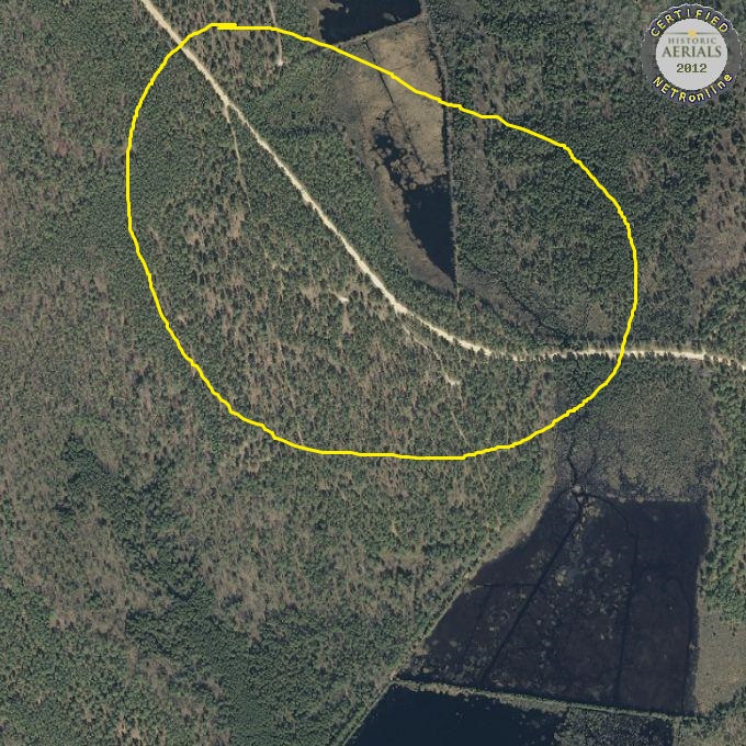
This map gives no hint that nothing other than forest and sand roads exist at this location.
1995 HISTORICAL AERIALS MAP

The area of Sandy Ridge is more defined, but still does not indicate any structural presence.
1984 HISTORICAL AERIALS MAP

Just bright white sand roads are all that is clear, but there may be building remnants in the section where Pioneer Gun Club once was. It also may show a utility building next to the cranberry bog.
1984 TOPO MAP
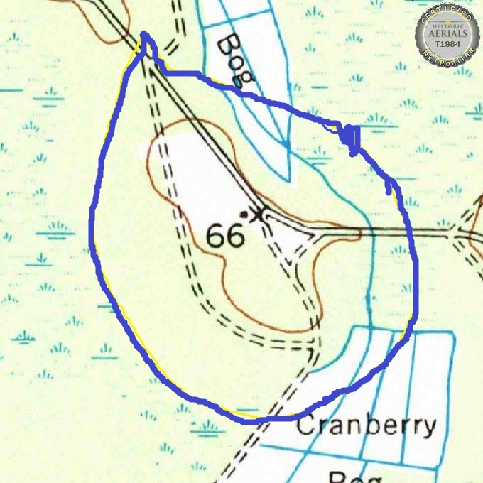
The topo map defines a building close to Carranza Road. It appears to be in the same spot as the aerial view.
1973 TOPO MAP
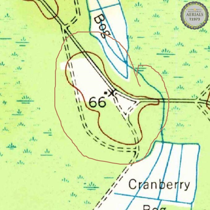
This map may be an earlier version of the previous map. Everything seems to be the same. The single building is quite obvious.
1970 HISTORICAL AERIALS MAP
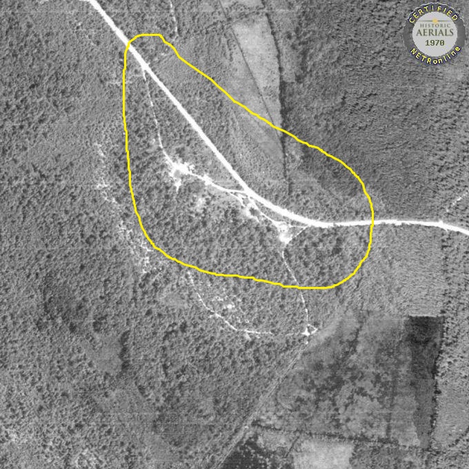
There is the slight hint of a building where the Pioneer Gun Club stood once.
1965 TOPO MAP
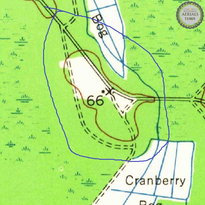
Again, we see what we have seen in the 1964 and 1973 topo maps.
1963 HISTORICAL AERIALS MAP
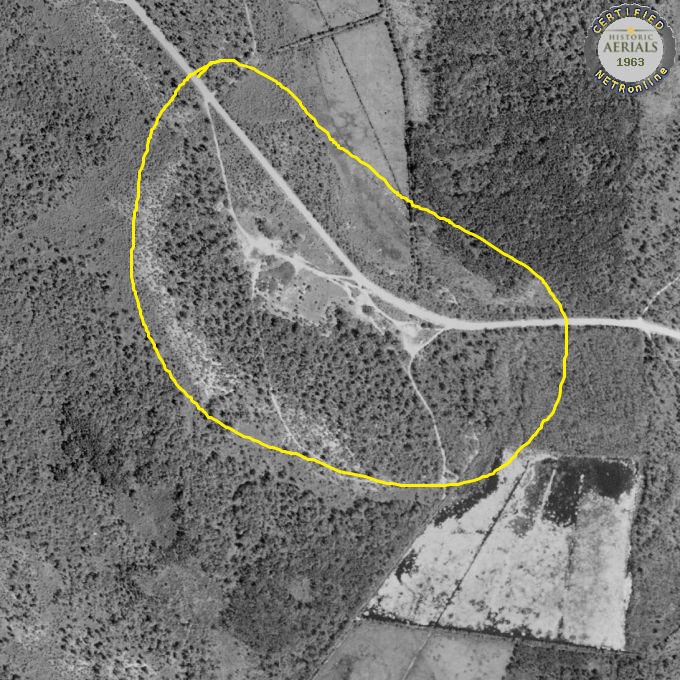
Clearer and sharper than most aerials, the Pioneer Gun Club hugs Carranza Road and at least one house is visible. It is also possible there is a house within the “arc” section.
1960 TOPO MAP

This is the 4th topo map which has the same features.
1956 HISTORICAL AERIALS MAP

A lot more shows on this map. The gun club is clearly defined, as are three and possibly four houses. Guy Thompson reports that an Earl Hill lived in one of the houses and that two others were leased. One by the Antler Deer Club, possibly the same club now in Shamong. The concrete block is also visible.
1955 Map of Wharton Buildings (courtesy of Guy Thompson)
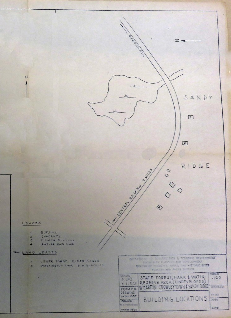
This very interesting state map confirms who occupied which buildings at Sandy Ridge. Pioneer Gun Club is depicted, as is Antlers Gun Club. They are at opposite ends of the property. One building, south of what is believed to be the Holloway House, is rented by an E. R. Hill. Another building, between the Holloway House and Pioneer Gun Club, is unoccupied.
TWO 1955 COURIER POST NEWPAPER ARTICLES
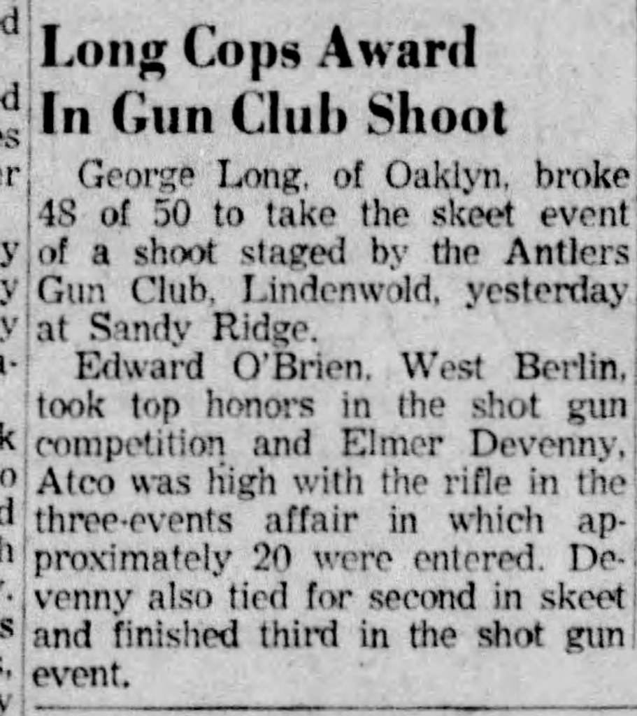
The Antler Gun Club held its annual shoot at Sandy Ridge. Barry Sinclair was the winner of the shotgun event and Elmer Devenney captured the rifle contest.
These articles confirm their presence at Sandy Ridge

1954 TOPO MAP
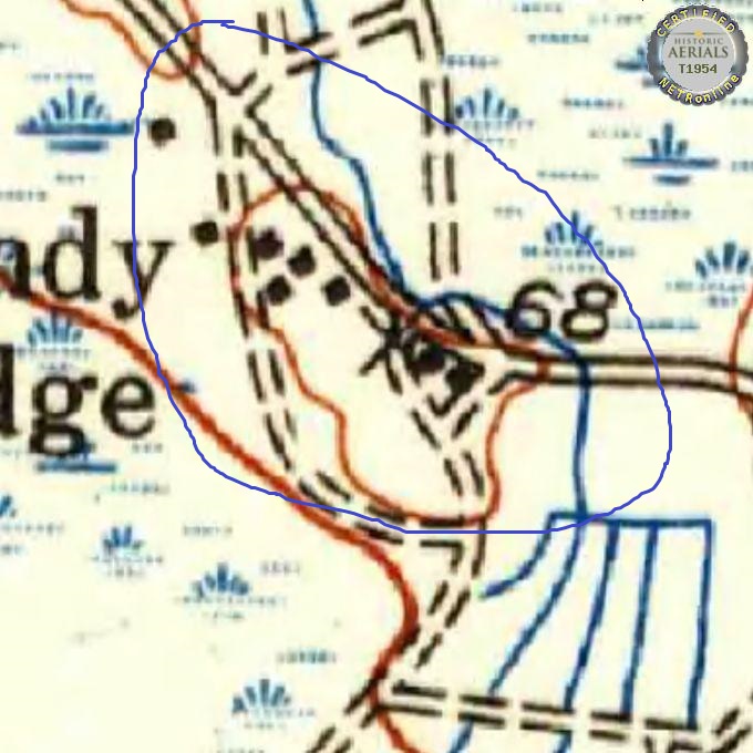
Showing Sandy Ridge before the Wharton Track was purchased by the State, there are at least eight buildings visible. Four are inside the “arc,” while two each appear in the Pioneer “triangle” and outside of the “arc.” The 1929 map defines many of these and will be noted there.
1951 TOPO MAP

Ten buildings now appear. The additional two are inside the “arc,” and given some information from Guy Thompson, they may be the two buildings moved and added to the Pioneer Deer Club structure.
1951 HISTORICAL AERIALS MAP

Most of the ten buildings in the 1951 topo are visible. Only one of those “outside of the “arc” is visible. The one seemingly missing is the migrant housing dormitory. The Pioneer building seems to have its two additions on it. The utility building beside the bogs also could be shown.
1950 Census

In 1950 it seems only one family lives at Sandy Ridge. It is Earl Hill (born 1887), his wife Rose Ann (born 1926) and their five sons. No occupation is listed for any family member so we might only speculate what either parent did for a living. The children were Earl (age 7), Edward (age 6), Robert (age 5), Barry (age 1) and Thomas (six months).
The census also indicates at least three vacant houses, so this family may be one of the last to reside at Sandy Ridge.
1942 TOPO MAP

Surprisingly, only four buildings show on this map. Most likely the mapmaker did not include all there.
1940 CENSUS

1940 Census: In 1940 there were three families living at Sandy Ridge.
Joseph Holloway: With Joseph are his wife Addie and daughters Mabel and Jean. He continues to operate the cranberry bog for the Wharton Estate.
Edward Holloway: Two new members have joined Edwards family. They are son Carol (1931-?) and daughter Shirley (1936-?). Edward is a laborer in the cranberry bogs.
Stanley Bakely: Stanley and his wife Florence, along with their five children, now live at Sandy Ridge. Stanley is a laborer for a road construction outfit. He does not appear to work in the cranberry bogs. The children are Stanley (1933-2011), Vernon (1934-2000), Shirley (1936-2016), Janett (1938-1989) and Virginia (1939-?).
In 1950 the families were living in Tabernacle.
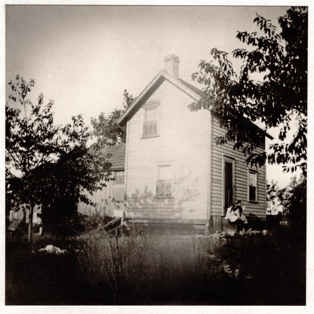
The following pictures are from the Holloway era at Sandy Ridge.
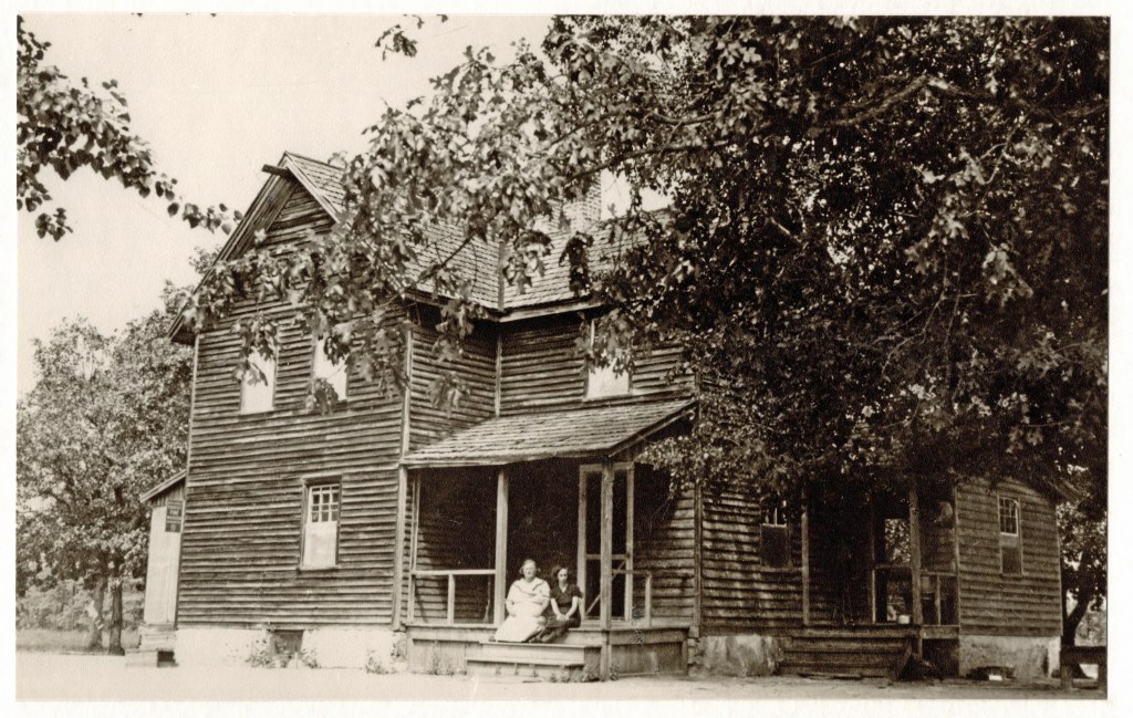
Addie and Mabel Holloway on the porch of the family home in Sandy Ridge.

Jean Holloway Sooy at Sandy Ridge.
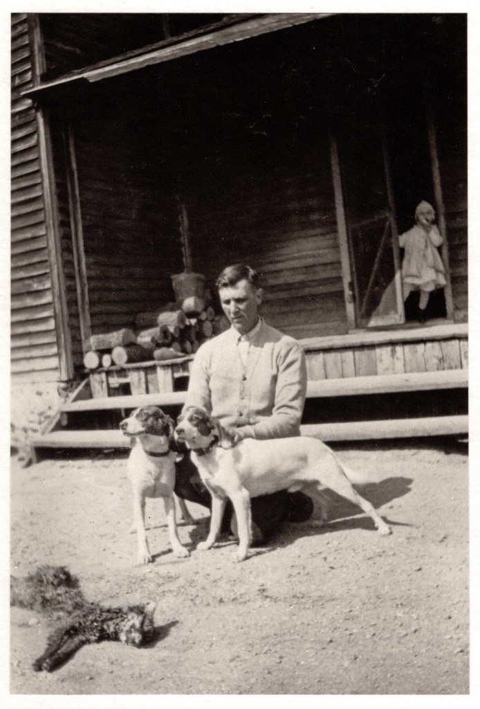
Joe Holloway at Sandy Ridge with hound dogs and possible bobcat.
Addie and the children at Sandy Ridge.

Addie Sloan Holloway (1886-1967) with children Mabel and Maud. Interloping is “Lilly.” Circa 1928.
1938 COURIER POST NEWPAPER ARTICLE
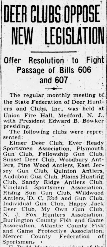
The Sandy Ridge Antlers Club attended the regular meeting of the State Federation of Deer Hunters and Clubs, at the Union Fire Hall in Medford.
1935 COURIER POST NEWPAPER ARTICLE

The Sandy Ridge Antlers Club held a meeting on Warren Avenue in West Berlin.
1934 COURIER POST NEWPAPER ARTICLE
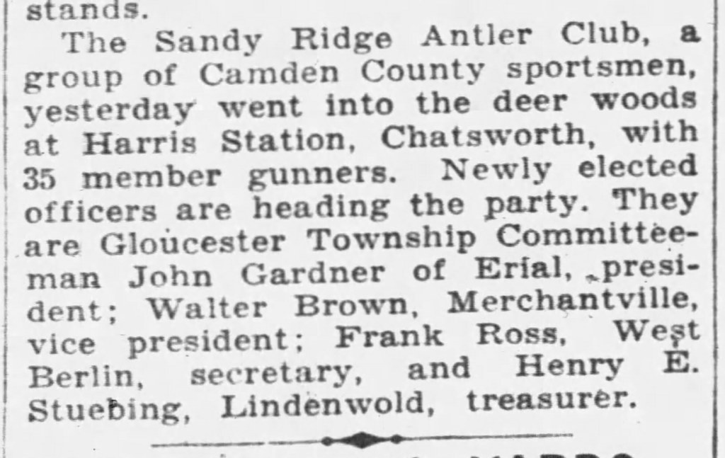
The Sandy Ridge Antler Club went into the deer woods at Harris Station. Thirty-five members and officers participated.
1931 HISTORICAL AERIALS MAP
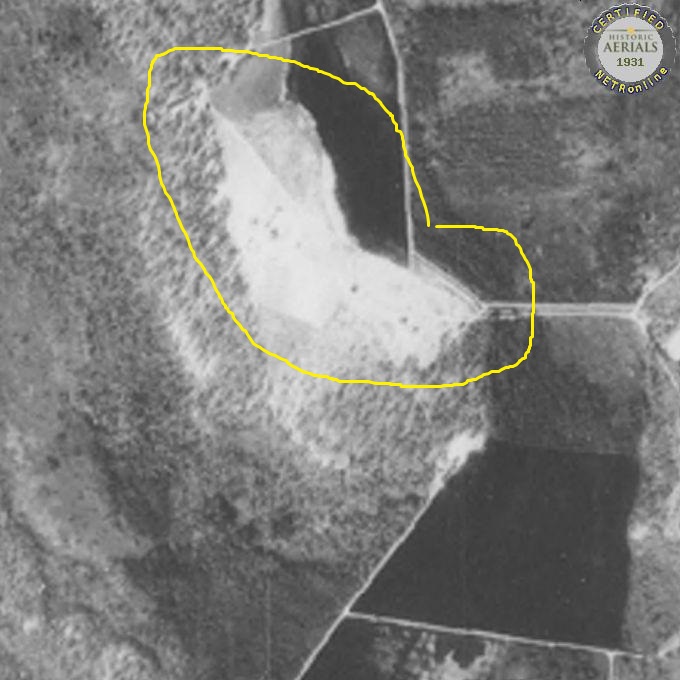
Quite out of focus, this is a difficult map to see. But at least nine buildings seem to be there.
1930 CENSUS

1930 Census: A review of the 1930 Tabernacle Census shows the following residents at Sandy Ridge. All worked in the cranberry bogs.
Joseph Holloway: Joseph (1878-?) is a manager of a cranberry farm. With him are his wife Addie (1887-?) and daughters Mabel (1909-?), Maud (1909-?) and Jean (1928-?).
Edward Holloway: Edward is a laborer in the cranberry bogs. He is 25 years old (1905-?) and is the oldest child of Joseph and Addie. His wife is Evelyn (1914-?) and they were married when she was 15.
Joseph Johnson: Joseph is a 54-year-old widower who also is a laborer in the cranberry bogs.
Ernest King: Another laborer working in the cranberry bogs, Ernest is 28 years old (1902-?). His wife Myrtle (1906-?) and children Daniel (1924-?), Charles (1925-?) and John (1927-?) live with him.
As a side note, this census shows James and Florence Forsythe living at Apple Pie Hill. He and his wife (from Northern Ireland and England) are servants in a sanitarium. And living at White Horse is one Oliver Jackson. Does this confirm a sanitarium on Apple Pie Hill?
1929 MAP FROM THE WHARTON COLLECTION AT THE STATE ARCHIVES
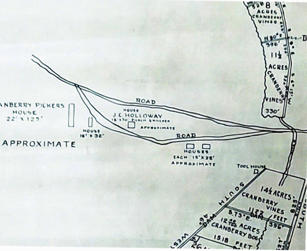
The location of the Holloway house is pinpointed, and its dimensions are given (18’x30’). The cranberry pickers house is noted, and it is a whopping 22’x125.’ Three other houses are also shown, two at 16’x28’ and one at 16’x32.’ The tool house is also noted over by the cranberry bog.
1920 CENSUS Sandy Ridge
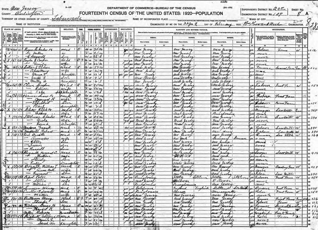
The 1920 Census lists Tabernacle residents who specifically live at Sandy Ridge. Here is a look at them and their families, as well as where they were in previous years. For those who were in the sawmill business, this helps pinpoint the mills year of operation.
William Theodore Bozarth (1861-1939): William is listed as the Manager of cranberry farms. Also, there are son Freemont (1898-?) and wife Anna Bell. Freemont is a laborer in a sawmill. There are two reasons, linked together, that indicate the location of the sawmill is near High Crossing. Henry Beck, in a 1930’s newspaper article, visited the area and noted a sawmill with 20-30-foot-high saw dust piles. He said it was “Bozarth’s Sawmill.” In the mid 1940’s local resident Harry Worrell and later Rickey Haines recall this particular site with the saw dust piles. By then the piles were only 8-10 foot high, as blueberry farmers had been taking the sawdust to put beneath their plants. We can trace’s William through census data other sources available on Ancestry.com.
1939 Obituary: William “Old Bill” Bozarth, a well-known figure in the Pines, died on August 2. He was a caretaker of the Wharton Estate and earned national publicity with his encounter with the Jersey Devil in 1928.
1930 Census: William is a caretaker for the Wharton Estate, living with his wife in Washington Township.
1915 Census: William is a sawyer and lives in Bass River Township. With him is his second wife Anna Bell. One six-year-old child (Howard P) lives with them in their rented home.
1910 Census: William is the manager of a lumbermill and lives on East Main Road in Bass River Township. With him are five children, including Freemont, and his wife Maggie. Son Howard, living with them, is a sawyer.
1905 Census: William is sawyer and lives in Bass River Township. With him are his wife Maggie and seven children, including Fremont. Son Howard is also a sawyer, while 16-year-old daughter Ella is a sawmill laborer.
1900 Census: William is a sawyer and lives in Bass River Township. With him are his wife Maggie Ford Bozarth (1869- 1912) and five children. Included among the five is Fremont.
Howard Caleb Bozarth: In the 1920 census Howard (1881-1970 )is listed as a sawyer. Undoubtably, he is the son of William T. With him are his wife Hattie (1880-?) and two teenaged children, Stanley (1906-?) and Evelyn (1908- ?).
1940: The family composition is the same as 1930, but they all now live on “New York” Highway in Bass River.
1930 Census: Living on St Louis Avenue in Egg Harbor City, Howard is a “huckster.” His family now includes a son in law and a granddaughter.
1918 Draft Registration: Howard is a “teamster” at Batsto.
1915 Census: Howard is a sawyer, living in Bass River Township, next to his parents, and with his wife Hattie and their two children.
1910 Census: Howard and his family are living with his parents in Bass River Township on East Main Road. He is a sawyer.
1900 Census: 19-year-old Howard lives with his parents on Union Hill Road in New Gretna.
The census data and draft card records show that in 1918 Howard was at Batsto and by 1930 he was in Egg Harbor City. Perhaps this narrows down the years of operation for the sawmill, on the broad side, from 1918-1930.
Peter Cipol: Born in Italy, Peter (1896-?) is a laborer at Friendship Farms. With him are his wife Hatti (1901-?) and son William (1909-?). No other collaborating information was found, but there is a possibility he is the Peter Cipoli later incarcerated in Pennsylvania. Interestingly, next to his name are others also working at Friendship Farms, but living in what appears to be, on the census, Friendship Bogs (?), Hampton Gate Road and one other undecipherable place.
They are Henry Sassanson (unclear spelling), Edward Curtis, Marge Batterson and her son Theodore, George Wishman, son Henry and Granddaughter Rebecca Miller.
Orville Ford: In the 1920 census, Orville (1893-?) works at a sawmill. His particular occupation is not decipherable. It may be farmer. With him are his wife Amanda ( 1892-?) and there three very young children (Elton – 5, Irwin – 2 and Russell – 1).
1950 Obituary: Orville died on 13 April while residing at 137 Grans Street in Hammonton.
1942 Draft Registration: Living at 135 S Monroe Avenue, Orville is employed by Atlantic City Electric Company.
1940 Census: In this census the Ford’s live on Monroe Avenue in Hammonton. His wife and daughter are the only other family members. Orville’s occupation is a “ground hand” in the electric company.
1930 Census: Orville is a truck driver living in Egg Harbor City on Boston Avenue. His wife, as well as another child (Evelyn born 1922) are with him. His wife and daughter are the only other family members.
1915 Census: The family lives in Washington Township. Orville and his wife are living with an older gentleman , Sam Ford, perhaps his father. He is a laborer, while Sam owns the property, and it is a farm.
1910 Census: Single, 17 and living with his father, Orville does “odd jobs.”
So in 1930 Orville is in Egg Harbor City (where Howard Bozarth also is) while in 1915 he is in Washington Township. Again, this helps define the time frame for the operation of the sawmill.
Robert Maxwell: Born about 1853, Robert seems to be the oldest resident of Sandy Ridge. He is a laborer in a sawmill and lives alone.
1885 Census: A J. Robert maxwell and his family (Emma and Maggie, Sarah, William and Joseph) live in Randolph Township.
1880 Census: A Robert Maxwell, born about 1854, lives in Bass River and works in a paper Mill. With him are Emma, Maggie, Sarah, William and Joseph.
1920 CENSUS Washington Township

This census shows the Holloway Family living in Jenkins Neck. Head of household Joseph is a farm laborer. So, his family moved to Sandy Ridge after 1920 and probably before 1928 (see picture).
1910 CENSUS (Washington Township)
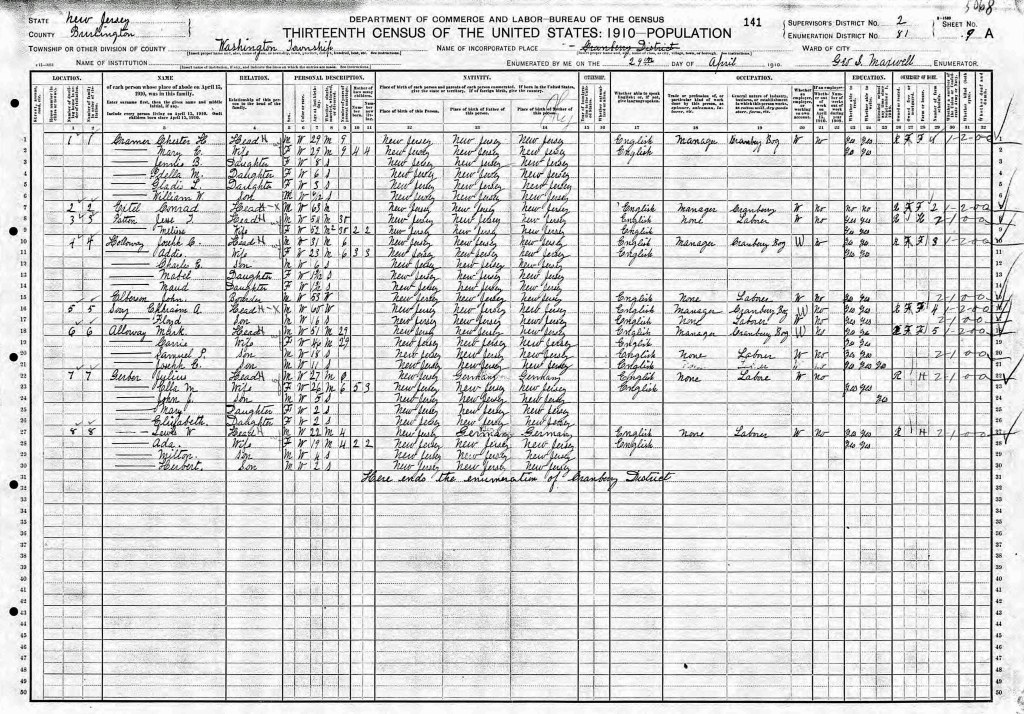
Joseph and his family live in Washington Township. Since his neighbors are the Mark Alloway family and the Julius Gerber family, he is living at Friendship. Joseph is the manager of a cranberry bog (Friendship Bogs).
Further research of earlier censuses turned up very little cohesive information. The land had been part of the Wharton Estate and undoubtably any study of its deeds would be very time consuming. Yet we will continue to seek earlier information. It would be especially helpful to know when the Sandy Ridge bogs were established.
An added bonus to this article is a summary of comments made by Jean Holloway Sooy in an oral, taped interview from 1992. It was one of at least ten such tapings set up by Garfield DeMarco and carried out by Betsy Carpenter.
The interview was conducted by Betsy Carpenter and Garfield DeMarco on August 10, 1992. Notes were taken from a video provided by Stockton University and with permission of the Woodland Township Historical Society.
Jean’s parents were Joseph Holloway and Addie Sloan. Her siblings were Eddie and twins Mabel and Maud. Jean was born in 1927, her sisters in 1908 and her brother in 1904.
Sandy Ridge was a cranberry only operation, no blueberries.
Neighbors at Friendship Bog were John and Anna Shinske, with their children Johnny and Alice. Alice was a deaf mute. Dominick Renzi was a worker at Friendship, which grew both blueberries and cranberries.
The WPA made Carranza Road a gravel Road.
In 1954 a massive forest fire hit the area. Jean went to Mt Holly. Rain came at the last minute and saved their property.
A friend was Ruth Eldridge Gerber, she was six years older than Jean. Ruth’s father was the railroad station master for the Atsion and the Chatsworth stations.
The two horses at Sandy Ridge belonged to the Wharton Estate.
In the wintertime ice was cut from the cranberry bogs. It was placed in either of two ice houses at Sandy Ridge. They were five to six feet deep. Sawdust was collected from a nearby sawmill (where there was a huge mound) ( probably Bozarth’s) and packed around the ice.
Sandy Ridge never had electricity.
At least six photographs were discussed in the interview. Many later became part of the “DeMarco” collection.
Joe Holloway’s father (Jean’s grandfather) was killed at Harrisville. Jean did not know the story.
In 1941 the family moved from Sandy Ridge to Chatsworth. Eddie Holloway moved to Tabernacle, near the “Haines” store.
Eddie’s wife ( Evelyn Applegate) drove a bus for the school district. Eddie worked for the County.
Joe Johnson left Sandy Ridge in 1942.
Hector Nicholson left about this time and he later married another resident Aura ??, who was a nurse.
Jean’s maternal grandparents were Edward Sloan and Christina Cobb.
Stephen and Anna Lee were neighbors at Speedwell. They had a big house on the west side of Route 563. It burned when Jean was quite young.
The Lee’s separated and Anna moved to Mt Holly. Stephen moved to Philadelphia.
Jean attended school for two years in Tabernacle, then went to Chatsworth. It seems like she went to 2nd and 3rd in Tabernacle and the school was the two-room schoolhouse by the Town Hall site. Her teachers were Betty Wilkins and May Stucky. This probably was about 1934-5. Jean remembers that the school was moved in 1936.
As she recalled, 7th and 8th graders went to Vincentown schools.
The twins went to school in Tabernacle and not to the school at Friendship (it may have been closed by then).
Joe Holloway used to have watermelon and cantaloupe parties at Sandy Ridge. He grew many vegetables by the homestead.
Jean sorta remembers the workers house at Sandy Ridge, it was not very near her house.
SANDY RIDGE LAND OWNERSHIP PRIOR TO STATE ACQUISITION
The land mass at Sandy Ridge came into state ownership in the 1950’s. Prior to that it had been part of the Joseph Wharton Tract. Using some relevant maps and property deeds we can approximate earlier ownership of that area called “Sandy Ridge,” where a small hamlet was once located.
Wharton tract land deals are confusing and not easy to trace. What may have been an individual land plot before Joseph Wharton’s land grab and the State’s consolidation of his properties, would eventually be lumped in with other plots and treated as one big tract. So to locate an early deed, one has to know the exact location of the land in question.
Today’s Sandy Ridge sits on Carranza Road, between the Featherbed and Tulpehocken Creeks. Luckily there is a collection of maps dated 1927 of Wharton’s holdings. This map collection can be found in the State Archives. As we look at two of the maps one can find what appears to be the Sandy Ridge area ( sheets 1 and 2 of the collection). However, there are no place names noted.
But what is noted is the size, previous owner and deed citation of individual lots. Wow! So, when we overlay the 1949 topo map with the 1927 Wharton map, we can confirm the Sandy Ridge location on both and now have deed information to research. The map indicates that Geo Dallas sold the land to Joseph Wharton.
In 1874 (30 September) Joseph Wharton purchased this area from one George M Dallas (Burlington County deed book A9 page 75). The price was $150.00. Dallas was selling the land as a trustee for the estate of William Patterson of Philadelphia. No acreage is mentioned in this deed but the 1927 map seems to indicate 47.7 acres. It is mentioned that it is “a large tract of land from the Atsion Estate.” The estate was partitioned by A K Hay, William Parry and Franklin Earle.
In 1865 (18 March) William Patterson purchased this area from John Stratton, Master (Burlington County deed book E7 page 396. The price was $500 and the acreage seems to be 119.25 acres.
A “Master” may have been used in this sale because two individuals, Franklin and Taunton Earl seemed to have been in a dispute about it. The land may have been owned earlier by Thomas Earl (possibly the father of Franklin and Taunton). Thomas may have purchased the land in 1758.
