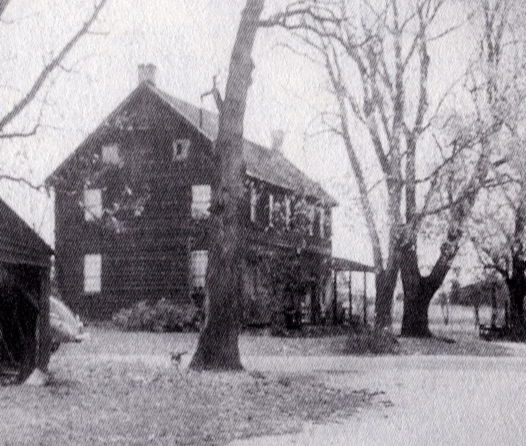
The former building stood until about 1975, when it burned and was destroyed. Its location is at the intersections of Old Indian Mills and Tuckerton Roads. No sure-fire confirmation of its use as a hotel has yet been found, and some experts question if indeed this building was ever a hotel. Often, this same intersection is referred to as “Oriental.”
From: Gordon’s 1833 map
A miniscule spec on the site where the building lies, indicates the building’s presence in 1833. There is no indication it was a hotel.

From: 1858 Kuhn map
A J. Naylor owns the building depicted. But once again it is not noted as a hotel. Whereas Pettit’s Hotel in nearby Flyatt is labeled as a hotel.
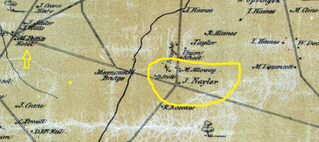
1876 Scott’s Atlas
J. B. Naylor is listed as the owner of this property, but again there is no designation that it was a hotel.

From: 1955 Signposts by Henry Bisbee
“Boyer is silent about there ever being a tavern at this place which rules out an Oriental Hotel.”
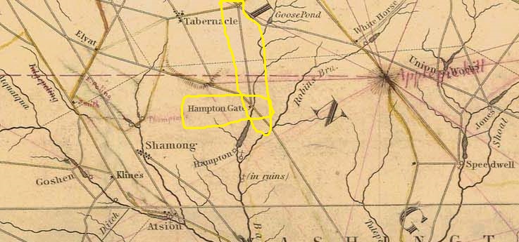
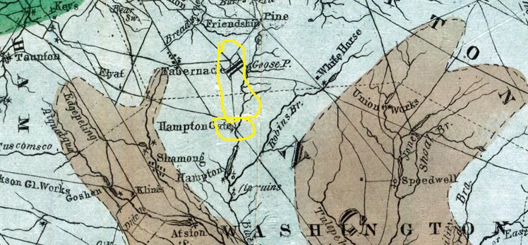
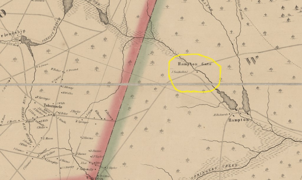
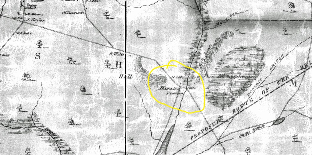
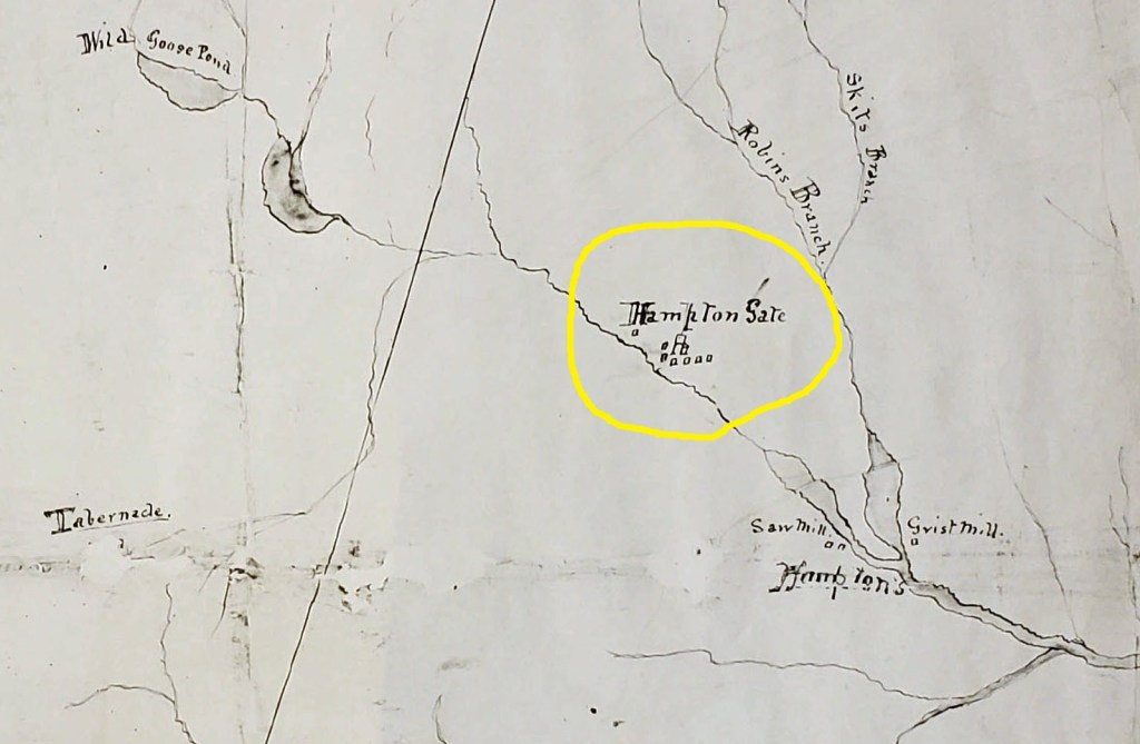
Hampton Gate Tavern
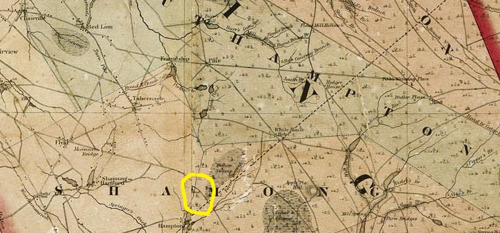
In 1820 Daniel Cavileer opened this tavern. After he passed, his wife became the operator. In 1849 a John Smith took over. Its exact location on Carranza Road is unknown. It is said to have been a “stone” tavern, but no evidence seen yet confirms this. An interesting aside is an 1839 geological survey map which shows a road in front of the potential tavern location. The road appears to be an extension of Irick’s Causeway, running from the Sooy Place Hotel at Pine.
However, as we closely look at both the 1849 and 1859 maps, we can see buildings noted. In 1849 a structure is seen between the Batsto River and the road to Hampton Furnace. It is labeled “J Smith’s Hotel.” In 1859 it is in the same location and the name “Flemers” is written beside it. Additionally, a structure can be seen above Hampton Road and in a location later identified as the spot where there is a “thuncking mill” (Later identified by many experts as a “turning mill”).
I
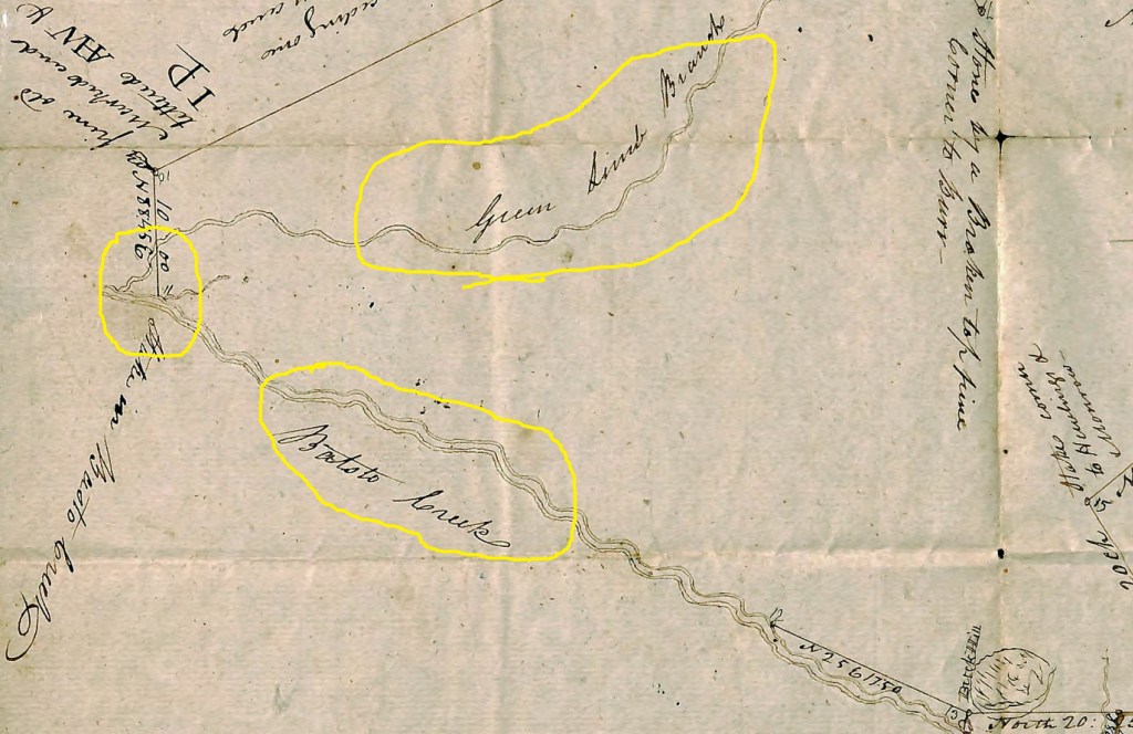
From: 1813 land survey
While the Tavern and the turning mill are not shown on this map, we can clearly see where the Green Limb Branch meets the Batsto River. This is the area where both were built in a later year.
From: Early Census
Josiah Smith
In 1830 there are four males and four females in Josiah’s living quarters. The youngest was born between 1825 and 1830.
The 1840 census shows seven people in Josiah’s household. The youngest male was born between 1825 and 1830, while the oldest male between 1790 and 1800.
In 1850 Josiah Smith is listed as a hotel keeper whose property is worth just $5000. This suggests a hotel far less in size than the one at Fox Chase. With Josiah are his wife Sarah and three children. By 1860 John P Smith has been seeking the annual tavern license renewals and the property value has dropped to $2825. In 1870 John P is a farm laborer living with Nathan Wright.
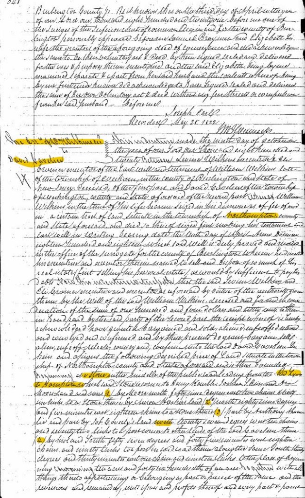
From: 1820 deed William Wilkins estate to David Cavileer (Book N2 Page 548)
While not thoroughly verified, this 10.46-acre parcel is along Carranza Road and seems to be right at Hampton Gate. The estate of William Wilkins sells it to Daniel Cavileer.
From: 1824 David Cavileer’s will
David’s will was filed on 17 March 1824. He left the bulk of his estate to his wife Mary, “for use and profits.” Probably meaning that she could run the hotel and collect
its proceeds. There are nine others who are mentioned in the will and the nomenclature used for many of them is interesting.
Mary Taylor Smith gets 200 acres near “Barge” Bridge Road. Samuel Leeds receives land “near his dwelling ….. to the “little mill” (perhaps the turning mill). John Clark inherits land near “Deep Run” and “Springers Creek.” Ann Leeds gets a cedar swamp north of the “White Horse Tavern.” The use of Barge Bridge Road instead of today’s Bards Bridge Road is particularly interesting.
As noted above, by 1850 Josiah Smith is operating the hotel. Somehow, he probably obtained it through the Smith family. When he passes on about 1855, his son John P Smith ends up with the property after a sale of Josiah’s estate. Since he left no will his ownings passed through probate. With not enough assets to cover liabilities, everything was sold. John P and a Sarah Smith were two of the buyers.
From: 1826 Josiah Smith license application
Josiah Smith applies for a license for the tavern “now called the Sign of the Buck.” And “that has long been run as a publick house,” he prays” for a continuation of his license. Among the signers of his petition is Lewis Mingin, who may have operated his own tavern.
From: 1828 Gordon map
The 1828 version of Gordon’s map shows a structure south of Carranza Road (then Hampton Gate Road)

From: Gordon’s 1833 map update
This map is very similar to the above but seems to show a road from Hampton Gate up to Irick’s Causeway Road and on to Sooy Place (Pine). This road is significant in that it shows why a potential hotel site north of Carranza Road is possible. It would have been on a direct route to the Sooy Place Hotel.
From: 1833 26 September New Jersey Mirror
An advertisement for a found sorrel horse appears in the newspaper. The finder is Josiah Smith, innkeeper, of the “Sign of the Buck.”
From: 1835 Josiah Smith license application
Josiah still “occupies the old stand known by the name of the Buck Tavern.”
From: 1839 Geological Survey map
Again we see what appears to be a road heading north up to the intersections of today’s Route 532 and Patty Bowker Roads. The hotel is barely marked just south of Carranza Road.
From: 1844 map
The unknown cartographer of this circa 1844 map places a structure north of the main road from Tabernacle.

From: 1849 Otley and Whiteford map
A J Smith is noted as the hotel’s owner. This would be Josiah Smith, whose son John took over operations in the mid 1850’s. While no connection has yet been found, it is strongly suspected that Josiah was related to David Cavileer, initial owner of the Tavern.
From:1850 Kirkbride Directory
Josiah Smith is listed as a Hotel Proprietor on Tuckerton Road, along with William Sinclair and Johanthan Cramer. Sinclair and Cramer are probably owners somewhere along the Tuckerton Road.

From: 1850 census
Josiah Smith (age 70) is a hotel keeper. With him are several other Smiths who appear to be children and grandchildren. They are Sarah (35), John (22), Maryann (18), William (18) and Kesiah Mingin (85). Note that George Wills is also a “hotel keeper,” more likely than not residing in the same building as Josiah.

From 1855: Josiah Smith license application
Josiah’s final license application shows that he has owned the tavern for at least 29 years. He asks the “judges to grant him a license to keep an inn and tavern in the house wherein he now resides.”
From: 1856 deed (Book Y5 Page 592)
Executors William Braddock and William Dyer, deed the property to John P Smith. He, in turn, quickly applies for a tavern license.
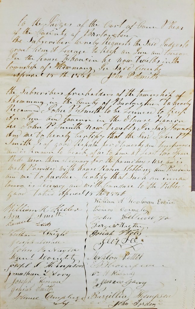
From: 1856 15 April John P Smith Tavern License application
On April 15th, John P Smith asks to keep a tavern in his house, in Shamong Township, where he resides. Sixteen signers are required. They are:
William Keeler Thomas Carmeley
Asa Smith John ????
Samuel Leeds George Hagerty
Nathan Wright Josiah ????
Joseph Small George Lee
John Naylor William Woolman
Daniel Doughty Mahlon Pettit
Joseph ???? ????
Jonathan ?ovy William Richards
Joseph Horner James Geary
Isaiah Smith John Sorden
?? Campbell Barzilliu Thompson
From: 1857 23 March John P Smith Tavern License application
Fee of $12.00 is paid by John P Smith. Fourteen signers are required. They are:
Isaiah Smith William Richards
Daniel Sinclair Patrick Millay
Harry Mingin Michael Milley
Ada Smith Eliz Naylor
Daniel Smith Oliver Wiltsee
William Kuler Allen Basell
Edward McIntyre Samuel Scott
John Kellman John Sprawls
Benjamin Small John Branin
Mathias Cotner William Cotton
Joseph Mingin John Sordon
From 1858 Kuhn and Janney map
Another map which shows the Hotel north of the roadway. Below the roadway is a house owned by a “Flemmers.” This most likely is “Flemming.”
From: 1859 15 March John P Smith Tavern License application
This years’ freeholder signatures are:
Joseph Munyon E Thompson
Patrick Millay Joseph Thompson
John Milbine Daniel Sinclair
Jonathan Hartman William Richards
Mathias Cotner Benjamin Small
John Sordon Daniel Mcneel
Nathan Wright
From: 1860 16 April John P Smith Tavern License application
Signing for the 1860 license are:
E Thompson Edward McIntyre
Daniel Sinclair John ????
Mathias Cotner Benjamin Small
J Thompson William Richards
J Hartman Joseph Small
John Kellman John Miller
Joseph LeMunyon John Sordon
Frances Mingen
From: 1860 Kitchell map
A statewide map in which you can barely see the word “hotel” at the site of Hampton Furnace. Nevertheless, it is another solid indicator of the hotel’s existence and location.
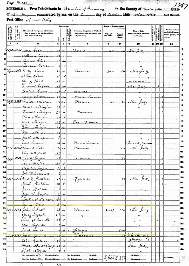
From: the 1860 census
John P Smith is a farmer with an estate valued at $2325.00 and personal estate valued at $1500. Living with him are a Sarah Smith as well as the George and Mary Bozarth family (with child Ellis).
From: 1861 Deed, Book T6, page 108 – (Burlington County deeds)
From: 1862 (circa) Washington Township map
In this map several buildings adjoin the hotel. In addition to a large building, there are seven outbuildings.
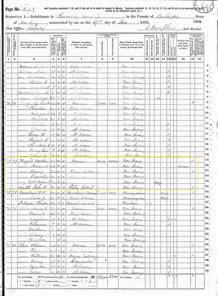
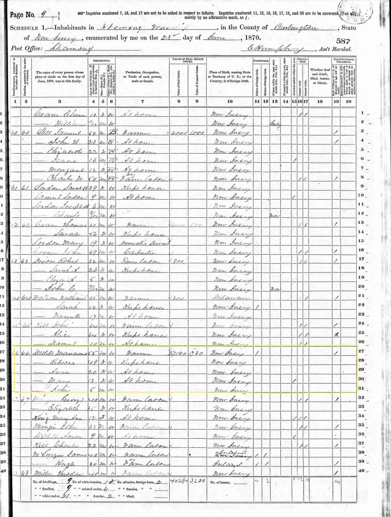
From: 1870 census
John P Smith is a laborer living with the Wright family. While Wright is a farmer, his real estate value of $16,000 suggests he could also be a hotel owner or perhaps have the funds from when and if he did sell the hotel.. We also have found that John P Smith sold land to Manassas Dellett and that in the Ccensus Dellett is worth some $27190, indicating that he may have indeed bought the hotel site. Both Censuses are below.
From: 1872 Burlington County Topo map
This highly colored topo map clearly shows Hampton Gate and it is notable that there is no designation of a hotel there.

From 1874 Wharton Era Map
This map does not any hotel reference but appears to cover the geographic area of the site. A property is owned by one Eliot Newman and it’s possible to be the hotel building. Since no census data notes a hotel operator, this may indicate the hotel was no longer functional.
From: 1876 Scott’s Atlas map
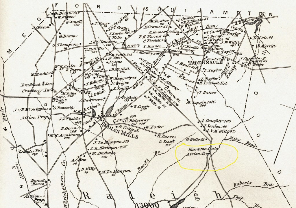
The potential hotel building is shown south of the road and the area is noted as “Atsion property.”
From: 1880 census
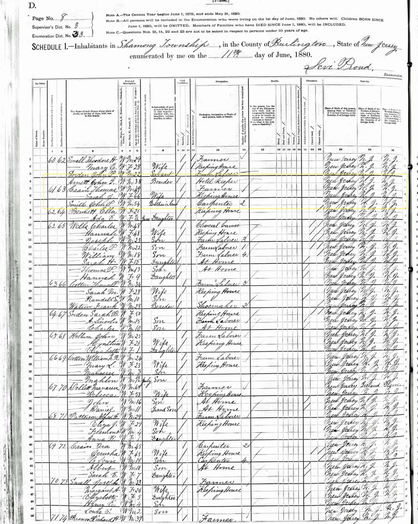
John P Smith is 54 years old and resides with his brother-in-law Thomas Crain. While Thomas is a farmer, John is a carpenter. This census to definitely suggest John is far removed from the hotel business. Yet a John Arnett, living in a nearby household, is a hotel keeper.
From: 1889 geological map
As in the 1878 statewide map, and the later 1888 Kobbel map, this map shows only a placename. There is no indication of a hotel.
From: 1936 Old Inns and Taverns in West Jersey by Charles Boyer
“Soon after the furnace at Hampton in Washington Township was built, a tavern was opened a few miles away, at a place called “The Gate.” The first tavern keeper at this house was probably Daniel Cavileer, who was here until 1824, when he was succeeded by his widow Mary.”
From: 1955 Signposts by Henry Bisbee
“Site of a tavern called The Gate, which was built soon after the furnace began operation. It was located a few miles north of the iron works. Daniel Cavileer and later his widow operated the tavern till 1824.”
Kemble Inn
In 1845 this structure was owned by Charles Kemble. In addition to his innkeeping, Charles was also a blacksmith and farmer. He also served as a member of the NJ State Assembly and the Sheriff of Burlington County. Prior to Kemble’s ownership, the White family ran the Inn.
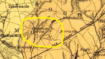
Some reports indicate the building was known as the Half Moon Tavern in 1800, and later as the Seven Stars Tavern. Its location is on Carranza Road, adjacent to the Russo’s Farm Market. However, recent research has shown it to be “The Sign of the Eagle.” See 1834 below for reference.
From: Benjamin White’s Probate
Benjamin did not leave a will. But from the probate of his estate, we can definitively see that an Alanson White was one of his nine children.
From: 1809 Deed Newbold to White (Book X page 240)
The White family begins its ownership of the land.
From: 1825 Deed Alanson White to Joseph White (Book S2 page28)
It appears that Alanson, father of Joseph, deeds the property to his son.
From: 1833 Gordon’s Map
While not marked as a hotel, the building does show on both of Gordon’s maps. Next to it, on the corner of the intersection, is another building.
From: 1834 25 December New Jersey Mirror
An advertisement for the sale of a farm includes this phrase – ” situate near the road leading from the Red Lion Tavern to Alanson White’s Tavern (Sign of the Eagle).”
1839 19 December New Jersey Mirror
In an advertisement for the sale of the property the following description is given.
“The improvements are a commodious tavern house, kitchen, barn, stables, wagon house, horse sheds; a good apple orchard and other fruit trees – the land is well adopted to grain and grass, all under cedar fence.”
From: 1839 Geological Survey map
A building shows at the spot of the Sign of the Eagle Tavern, but again there is no designation of a hotel.
From: 1844 State Map
This map has hand drawn images where houses/buildings are placed. While not labeled as an “Inn,” it clearly is the building for which Charles Kemble obtained a hotel license. In 1844 it seems to be owned by an Alanson White.
From: 1845 Deed W Irick and Joseph White to Kemble (Book I4 page 580)
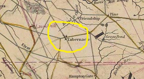
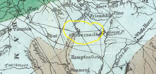
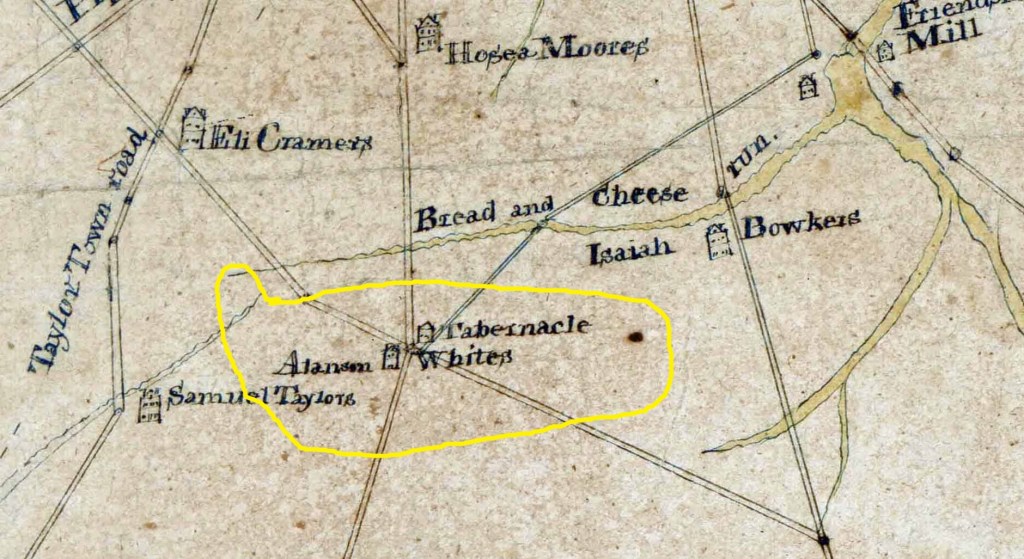
Some interesting terminology in this deed. The property is called the “Tabernacle Tavern Property,” and the “Tabernacle Meeting House” is noted.
From: Early Censuses
Charles Kemble
The earliest census we see Charles Kemble appear in is the 1850 census. He is listed as a farmer with a land value of $2500. With him is his wife Sarah and three children. In 1860 his child count has risen to seven, while his property u has dropped to $2000. In the NJ census of 1865, he still appears in Shamong, but by 1870 is living in Northampton. His occupation has also changed, as he is now the County Sheriff.
From 1849 Otley Map
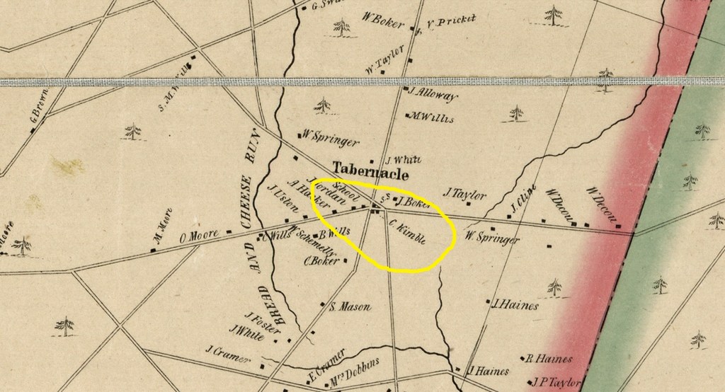
A C. Kemble is now clearly the hotel owner. We also continue to see a building on the corner of the intersection.
From: 1850 census
Charles Kemble is a farmer whose estate is worth $2500. With him are his wife Sarah and three children. They are Matilda (age 7), Henry (age 5) and Eldridge (age 1).
From: 1855 Charles Kemble Tavern License application
Charles paid $12.00 for his license at “the Tabernacle” in Shamong Township. Fourteen “subscribers” attested Mr. Kemble’s worthiness. They are:
Charles Bowker Wesley Taylor
Ebenezer Davis Eli Bowker
John Alloway Henry Smith
Caleb Wright Henry Kemble
Benjamin Willets Isaac Cramer
Joseph Houston Hosea Moore
John White
From: 1856 Charles Kemble Tavern License application
After another annual $12.00 fee, another license is granted at “the Tabernacle in the township of Shamong.”. Eli Bowker testifies that one “freeholder,” Stephen Haines, is not a resident of the township (Shamong). The complete list of signers is:
Wesley Taylor Henry Kemble
Henry Smith Ebenezer Davis
Eli Bowker John Alloway
Joshua Jones Gilbert Swain
Caleb Wright Joel Carmely
Josiah Huston Stephen Haines
Benjamin Willets William Carmely
1856 “freeholders”

From: 1857 6 April Charles Kemble Tavern License application
Those signing this year are:
Wesley Taylor Ebenezer Davis
Caleb Wright James Tetlow
Eli Bowker John Foster
Benjamin Willets Benjamin M????
Henry Smith Aaron Doughty
Henry Kemble Marmaduke Alloway
Josiah Huston
From: 1858 Kuhn and Janney
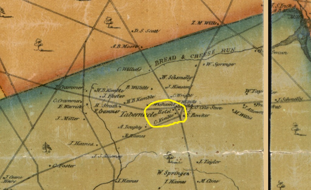
The hotel is shown with ownership by C. Kemble.
From: 1858 20 Mar Charles Kemble Tavern License application
Signed by:
Nathan Wright Gilbert Swain
George Scott Wesley DeCou
Eli Bowker Isaiah Haines
Henry Kemble Henry Smith
Joel Carmaleys Caleb Wright
James Tetlow Josiah Huston
Wesley Taylor Benjamin Willets
From: 1859 19 Mar Charles Kemble Tavern License application
This years’ license fee is only $10.00!! Freeholders signing the petition are:
Josiah Huston Joshua Jones
Benjamin Willets Henry Smith
William Carmelle Henry Kemble
Wesley DeCou Gilbert Swain
Isaac Cramer John Alloway
Ezekiel Wright Eli Cramer
Joel Carmelle
From: 1860 Census
Charles is a 40-year-old farmer whose real estate is valued at $7200. All the children are in the home. The oldest is Matilda at 17, while youngest is Charles Jr. at 3 months.
From: 1860 17 April Charles Kemble Tavern License application
Charles’ annual tavern fee is still $10.00. The petition is endorsed by:
Eli Bowker John Alloway
George Wills Wesley Taylor
James Tetlow Henry Kemble
Caleb Wright Josiah Houston
Westley DeCou Wm Carmelle
Josiah Haines Aaron Doughty
Joel Carmeley Gilbert Swain
From: 1865 New Jersey Census
There are now nine members in the household, but we are not given the relationships between them. However, Charles, Sarah, Matilda, Henry and Eldridge are there. The others are aged 5 (Charles Jr.), 11 (Annie), 9 (Joseph) and 13 (Caroline).
From: 1866 Talbot and Blood Directory
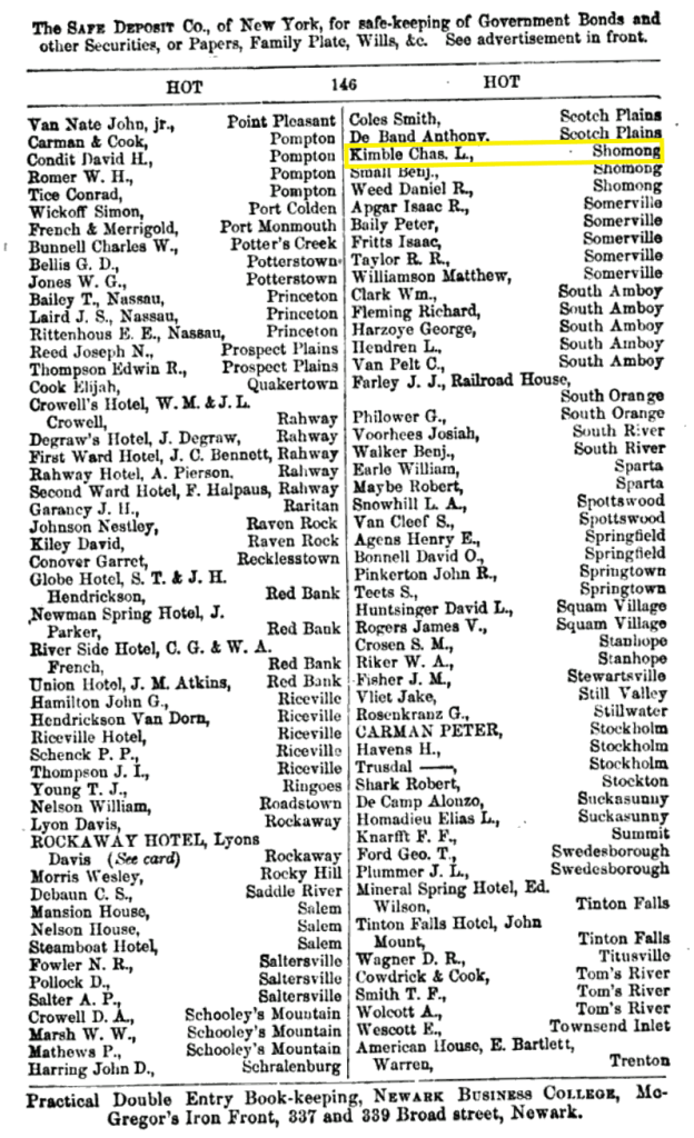
Three hotel owners are shown in “Shomong.” Chas. L Kemble is one of them.
From: 1870 census
This census provides us with a little more information. Charles is now the Burlington County Sheriff, and his property is worth some $8000. Son Henry is a clerk in the Sheriff’s Office while the four youngest children attend school. Matilda is not at home because she has married to a neighbor, Charles Wisham. Since the family now resides in Northampton Township, we know another owner has possession of the Inn.
From: 1876 Scott’s Atlas
Clearly shown on this map, the inn may have a different owner or just an additional initial to Kemble’s name. It reads “S. C. Kemble.”

From: 1896 Deed Kemble et al to Haines (Book 286 page 69)
The estate of Charles Kemble sells land to Richard H Haines.
From: 1905 Deed Haines to Hughes (Book 394 page 212)
Albert Hughes buys the land from Richard Henry Haines.
From: 1920 Deed Hughes to Allen (Book 567 page 281)
Albert Hughes sells the property to Victor Allen.
From: 1946 Deed Allen to Fletcher (Book 1003 page 11)
Victor Allen sells his dairy farm to Mervin Fletcher.
From: 1967 Deed Marvin Fletcher to A Russo (Book 1637 page 1177)
Among other acreage, Fletcher sells 80 + acres of his dairy farm to Anthony Russo.
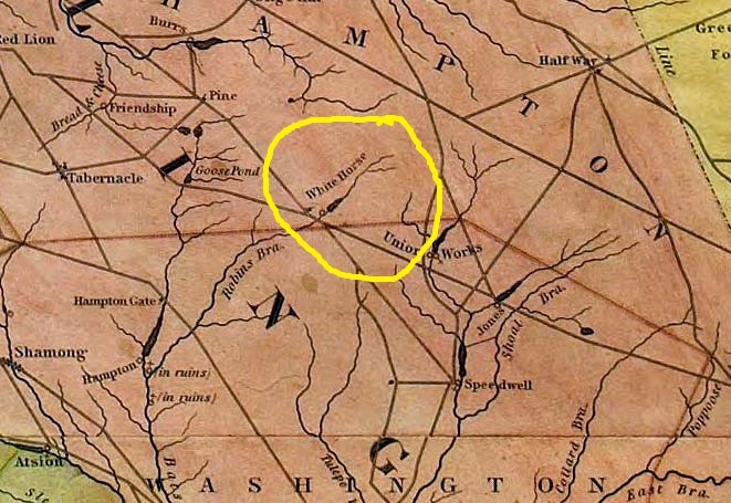
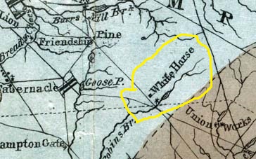
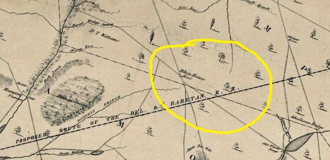
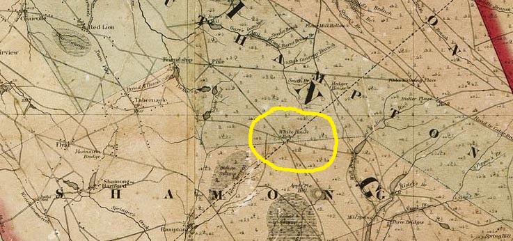
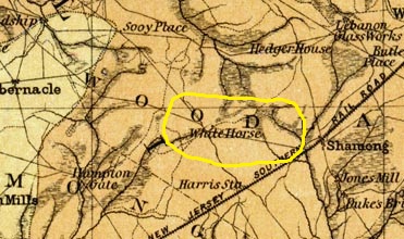
White Horse Tavern
In 1785 a Lewis Mingin is the Tavern Keeper and by 1824 it is Noah Sooy. The site is located close to the infamous land scandal known as Paisley. At one point the Tavern may also have been know as Robins Meadow Tavern.
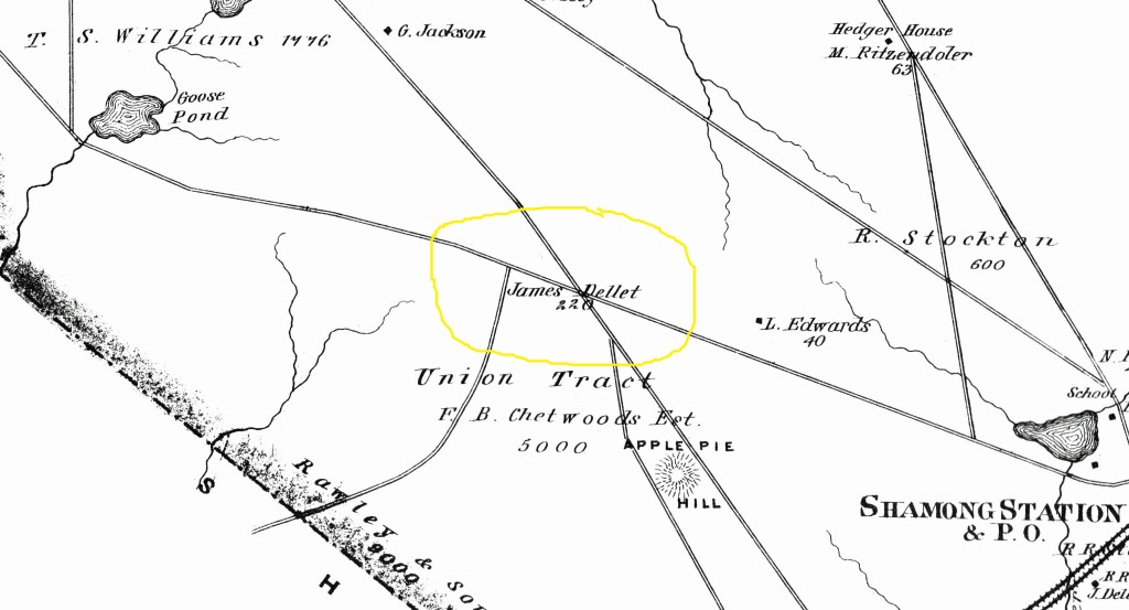
Nothing can be seen at the site today. In fact, its exact location is currently unknown. It is in the area of Chatsworth Road (Route 532) and the Bordentown Gun Club. Its curious to note that a tavern of the same name exists in Chatsworth and the connection between the two is not known. However, it is possible that the later tavern was constructed after the former burned down and was named for the earlier one. Reportedly a James Delette had owned the former and built the latter.
From: 1815 will of Nicholas Sooy
The will defines how his estate is to be settled. Under item number four, Josephus gets “the plantation and tavern which I purchased of Revel Elton (Sooy Place or Pines). And under item number nine “after the death of my wife I bequeath the tavern in which I now reside to my son Sears.” However, through tavern licenses, we know that this tavern is in Washington Township, and more likely than not, is the famous Washington Tavern.
From 1828 Gordon’s map
A very small mark on the map shows the hotel just north of the Robbin’s Branch. It does appear to be north of South Park Road, prior to the intersection with today’s Chatsworth Road.
From: 1833 Gordon’s map
The tavern site is marked clearly on the 1833 Gordon’s map. It’s on the north side of a road leading up to Hedger House.

From: 1839 geological map
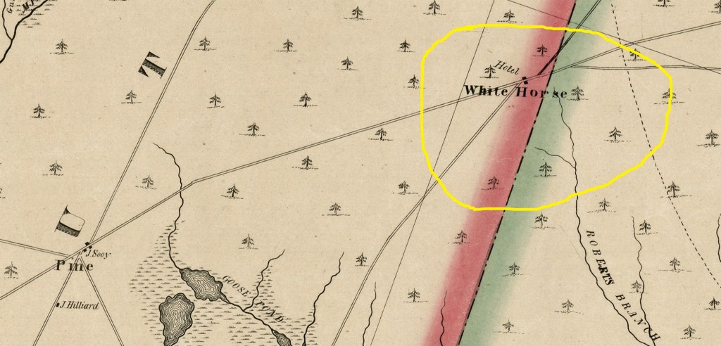
Again, “White Horse,” is shown on today’s South Park Road, a bit north of Robin’s Branch and Chatsworth Road.
From: 1844 Map
The hand drawn hotel adds a nice character to the hotel’s depiction on this early map.

From 1849 Otley Map
On this map the direction “east” is at the top and “north” is at the bottom. The hotel is clearly labeled as is a structure across the street from it.
From: 1858 Kuhn and Janney Map
Again, the hotel is clearly noted as is a second nearby building.
From:1860 Kitchell map
This statewide map, when expanded greatly, does show the White Horse Hotel.
From: 1862 Washington Township Map
Standing alone all by itself is the White Horse Inn. This crudely drawn map of the old Washington Township, seems to have place the Inn rather randomly and approximately where it stood.

From: 1872 Burlington County topo map
The vivid colors of this map highlight the existence of the hotel as well as its potential location. It seems to be on South Park Road just a tad north of today’s Route 532.

From: 1876 Scott’s Atlas
Surprisingly, no hotel shows on the site. But we do see the name of James Dellett, believed to once be the owner of the Inn.
From: 1878 Map
The hotel is strongly noted on this map. We also see a few other nearby buildings. While the land fraud scheme of Paisley has not yet begun, there does seem to be a building in the Paisley area.

From: 1887 Geological Map
White Horse is shown as a place name, but no building is shown. Map not added to this page.
From: 1889 Kobbe map
Again, only a place name is shown. Map not added to this page.
From: 1889 Geological Survey Map
If you look closely, an apparent building is depicted at the hotel site on a road leading up to Hedger House. Pehaps the cartographer got his information from an earlier map, because by this time the hotel was probably in ruins.
From: Various 1888 deeds re Paisley and H. L. Freeman
In several of Freeman’s acquisition deeds for his Paisley land scheme, we see many references to the White Horse Tavern. They are couched in terms of landmarks which signify property boundaries. We read the following “Goes along the road where the Old White Horse formerly stood,” “Where the Old White Horse Tavern formerly stood,” “Goes along the road from the Old White Horse Place to Sooy Place,” and, “Old Sooy Place to White Horse.” So, by 1888 the Tavern was long gone.
From: 1936 Old Inns and Taverns in West Jersey by Charles Boyer
“At the intersection of the road from Vincentown to Speedwell with the one from Red Lion to Manahawkin, was an early tavern. Lewis Mingin is the earliest known tavern keeper at this house and was licensed in 1785 and in 1824, was succeeded by Noah Sooy. It is sometimes referred to as ‘the White Horse Tavern commonly called Robbins Meadows.”
From: 1955 Signposts by Henry Bisbee
“Boyer tells us that the White Horse Tavern was established in 1785. He also states that the place was “Commonly called Robbins Meadows.” Charles Boyer was a careful researcher; however, this writer offers a possible correction. In the 1831 road returns reference is made to a road “from Goose Pond to Alanson White’s Tavern.” The only road from Goose Pond, (1859 map) at that time, is directly to White House Hotel. Yet earlier maps and all later maps name the place White Horse.
“Robbins Meadows, after Tom Roberts of New Hanover for whom Robert’s Branch is named.”
Tabernacle Hotel
Newspaper advertisements of the 1830’s and 1840’s mention Eli Cramer, his Tabernacle Hotel and the placename Tylertown. This former hotel exists today as a residence in “Tylertown.” Here are examples of two of them.
1839 19 December New Jersey Mirror
“…. By virtue of a decree of the Orphans Court of the County of Burlington in the November term AD 1839, will be sold at Public Venue at the Tabernacle Hotel now occupied by Eli Cramer.” The property for sale was Alanson’ White’s Tabernacle Tavern (Sign of the Eagle).
1840 9 April New Jersey Mirror
“…. By virtue of a decree of the Orphans Court of the County of Burlington in the November term AD 1839, will be sold at Public Venue on Saturday the 25th of April next at the house of “…. By virtue of a decree of the Orphans Court of the County of Burlington in the November term AD 1839, will be sold at Public Venue at the Tabernacle Hotel now occupied by Eli Cramer.” (Tabernacle Hotel).” The property for sale was 25 acres of woodland.

